Digital Konohiki - 1
Kamaole 1 Beach Clean-Up Project
The Maui Moku Puni Geodatabase (MMP-GDB) and the Hawaii Statewide GIS System act as the Spatial Nervous System of the Modern Day Kamaole Ahupuaa.
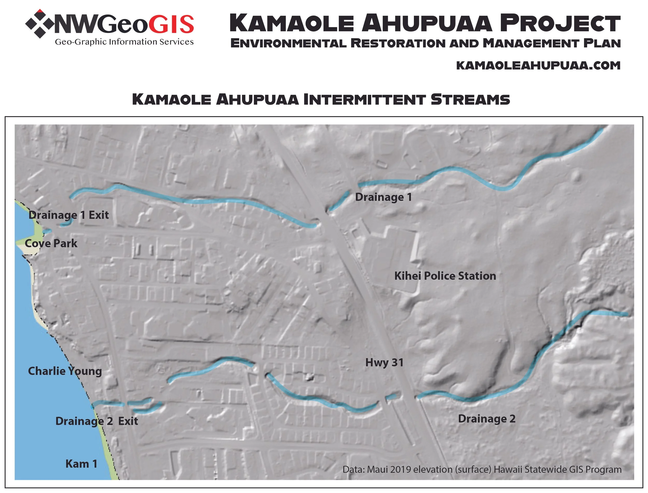
The Hawaii Statewide GIS Digital Terrain Model uses LIDAR scanning technology to give a bare earth base map to improve visualization of drainage and topographical features.
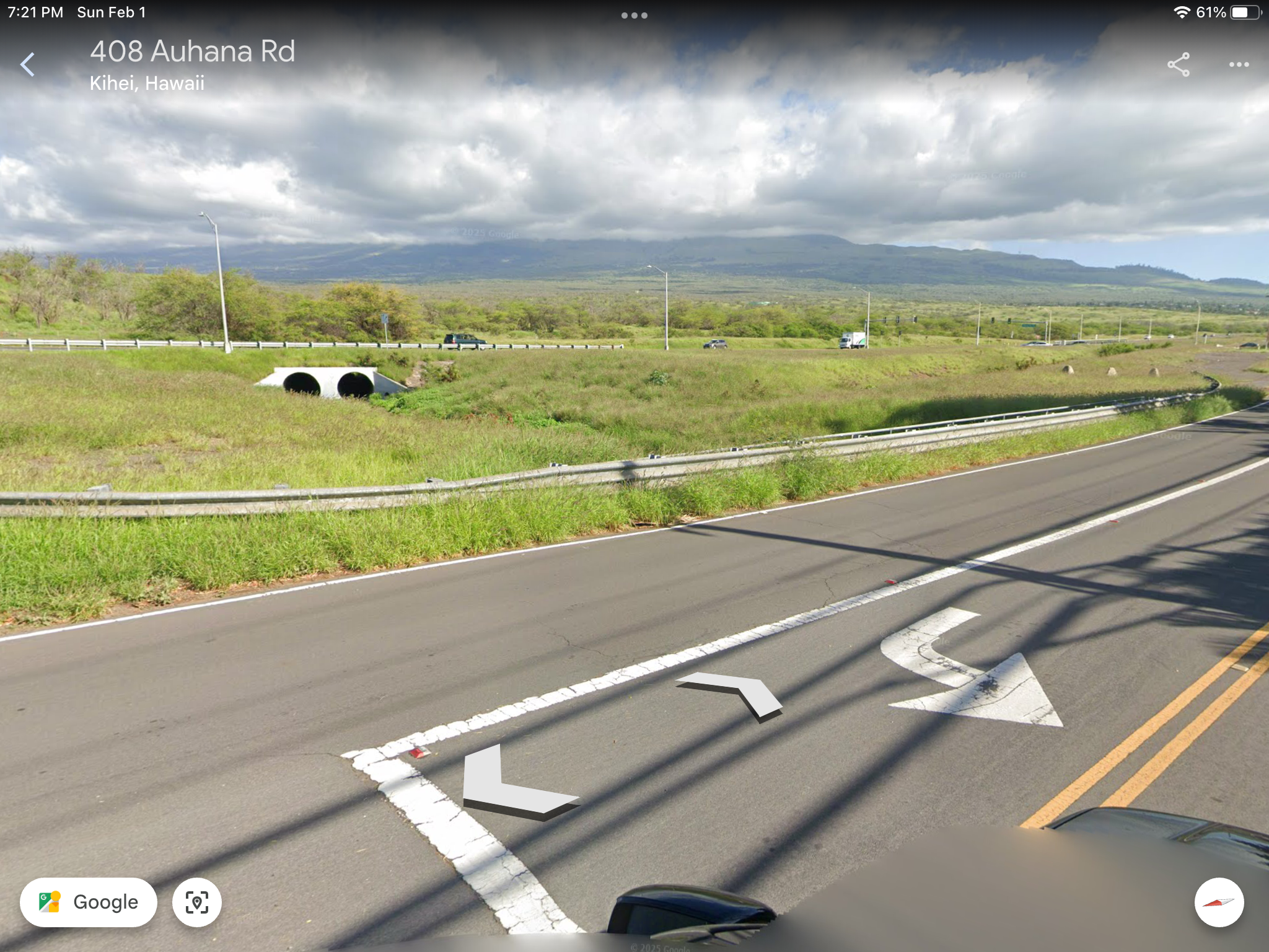
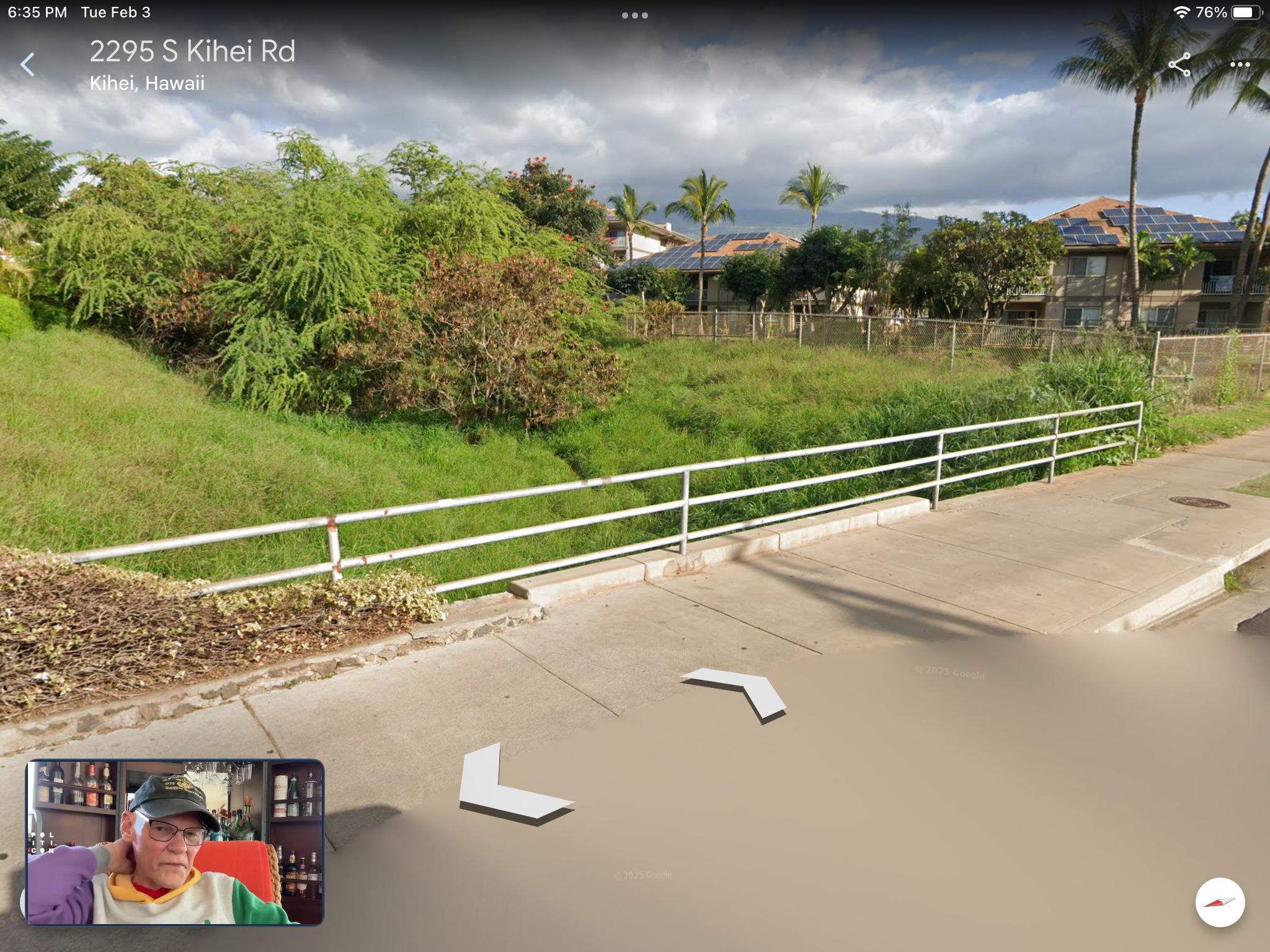
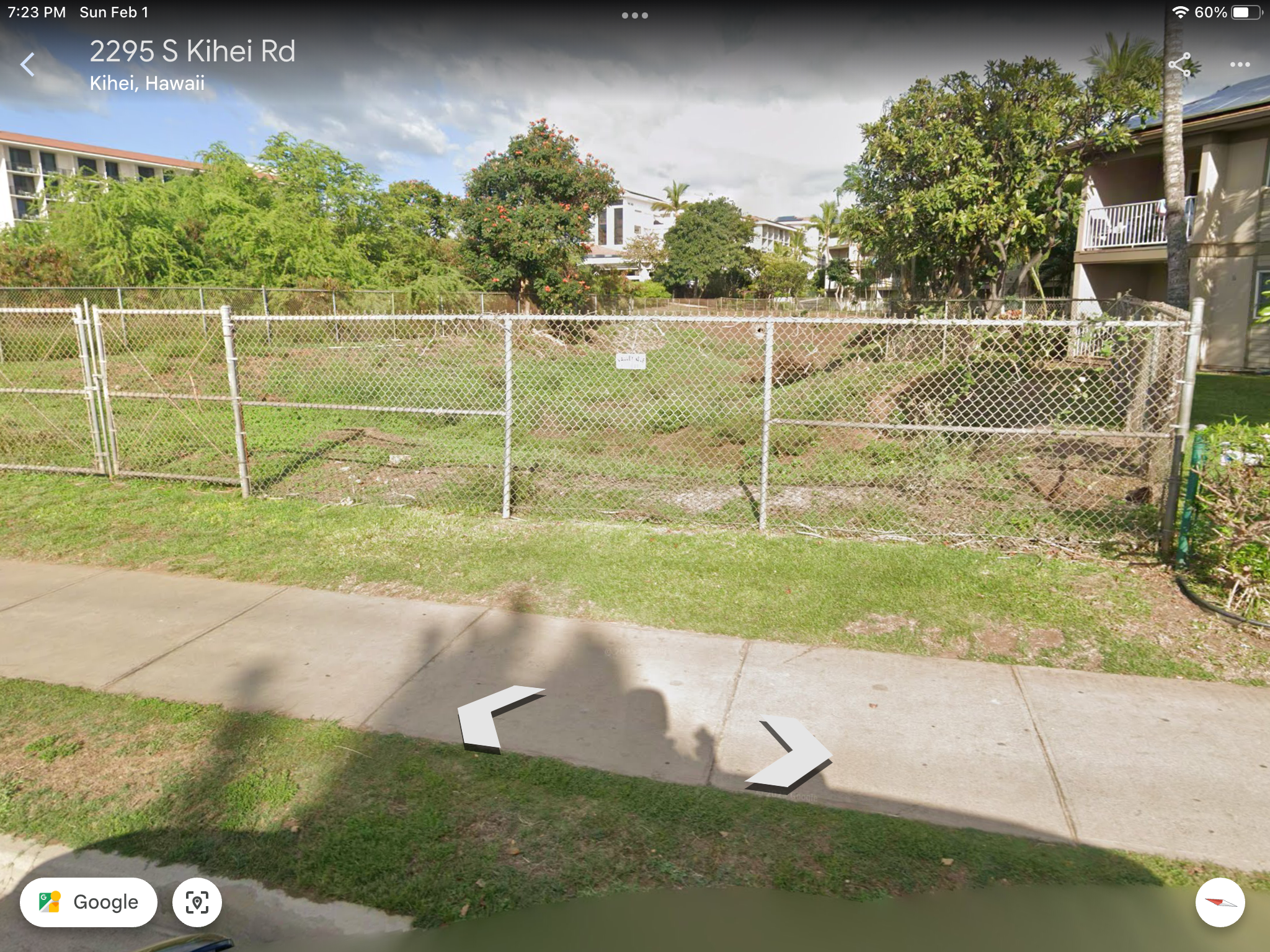
Google Earth screen shots looking at Drainage 2 as it passes under Highway 31 and flows through the lower neighborhoods to Kamaole 1 Beach.
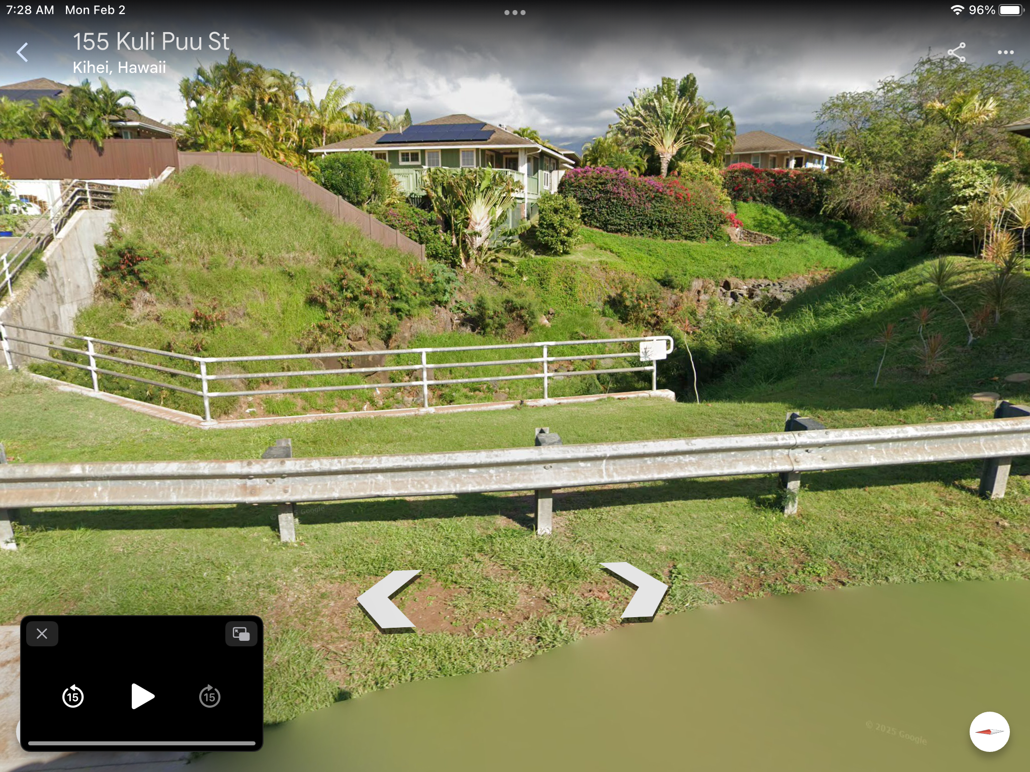
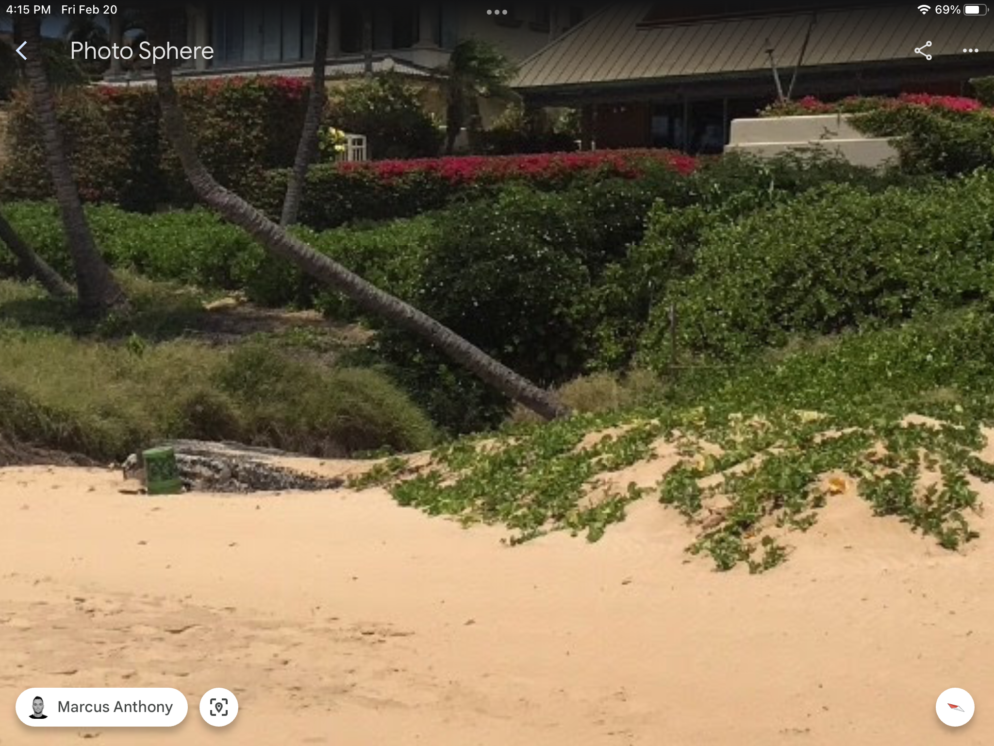
Drainage 2 exit point at the north end of Kamaole 1 Beach Park. Reducing runoff and sedimentation from heavy rainfall events is the longterm challenge.
Make a Donation
Help build the vision of a functioning Modern Day Kamaole Ahupuaa. Small donations and product purchases help pay for the website and the cost to develop the Maui Moku Puni Geodatabase until longterm funding is in place and the next generation is trained and leading the way. Every contribution —big or small—helps create a world that reflects our shared values. Your support moves us all closer to a brighter tomorrow.
• Ceramic
• 11 oz mug dimensions: 3.79″ (9.6 cm) in height, 3.25″ (8.3 cm) in diameter
• 15 oz mug dimensions: 4.69″ (11.9 cm) in height, 3.35″ (8.5 cm) in diameter
• Lead and BPA-free material
• Colored rim, inside, and handle
• Dishwasher and microwave safe