Digital Konohiki - 5
Modern Day Kamaole Ahupuaa Digital Konohiki
The Modern Day Kamaole Ahupuaa Partnership
Within Kamaole the residents, visitors, workers, property owners, businesses and government all play critical roles in the day to day functioning of the community.

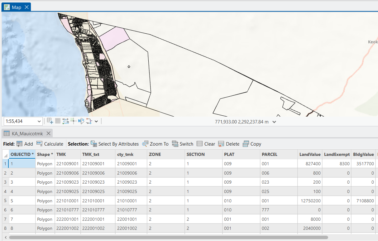
Today the Kamaole Ahupuaa is divided into 1656 individual tax map parcels. Coordination of activities and resource use amongst the key partners is critical for the health of the community, economy and the environment. Managing these relationships becomes the role of the Modern Day Digital Konohiki.
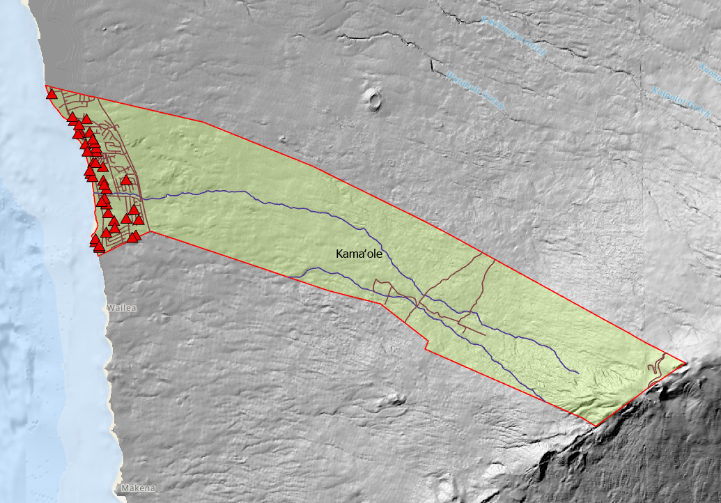
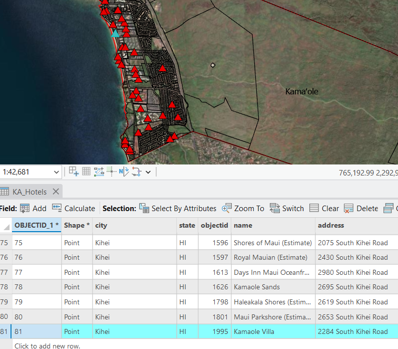
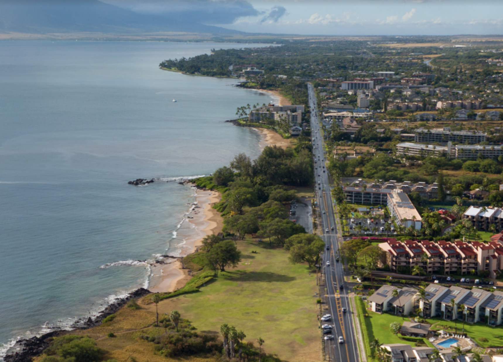
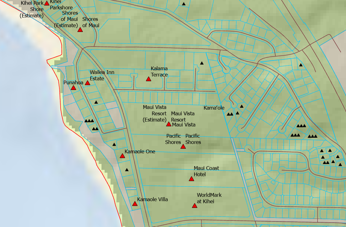
Currently 81 of the 1656 properties in Kamaole are identified in the Hawaii Statewide GIS System “Hotel” data layer as part of the “Visitor Plant Inventory / VPI.” These properties fall into five different categories.
Hotel - 2
Condominium Hotel - 4
Individual Vacation Unit - 60
Timeshare - 6
Bed and Breakfast - 9
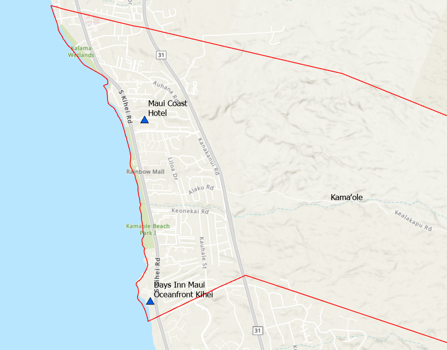
Two properties operate as traditional hotels. The Maui Coast Hotel, with 427 rooms is the largest. The Days Inn has 87 rooms. Visitors staying at these locations do not have access to kitchen facilities and are looking for meals each day.
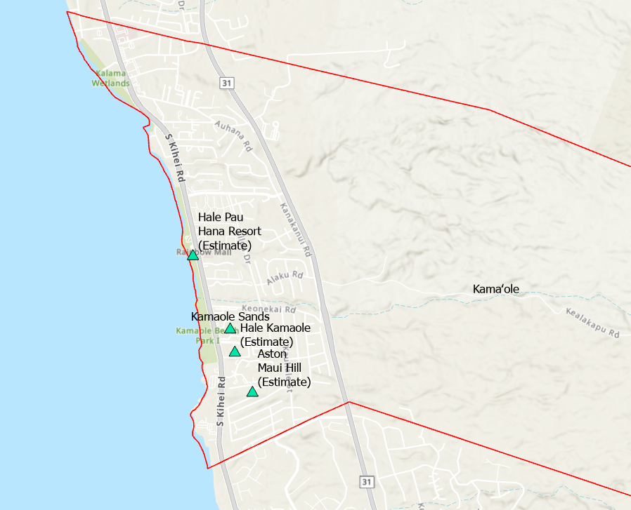
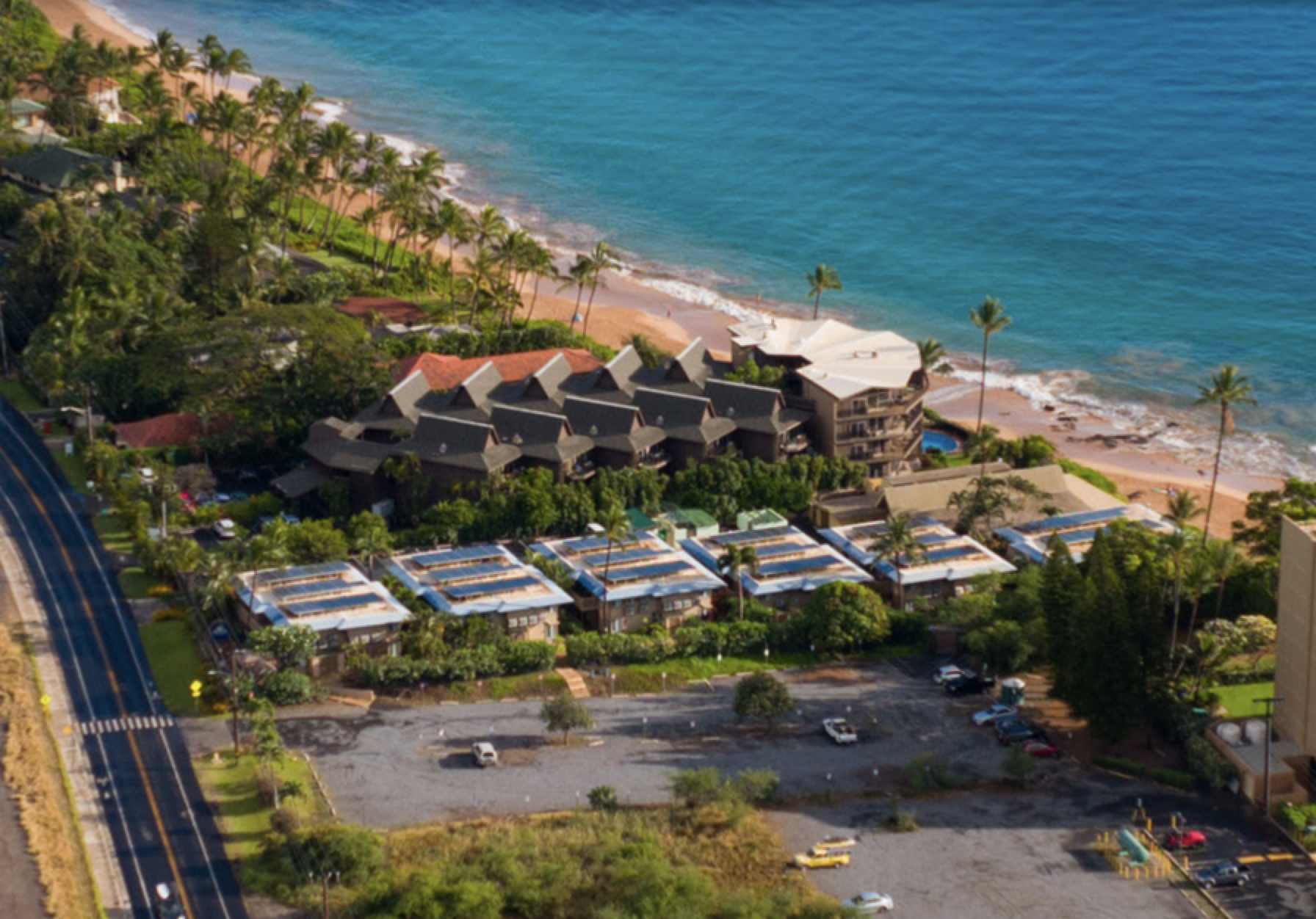
Four Condominium properties within Kamaole also operate as hotels with the occupants having the ability to shop and prepare meals within their accommodations.
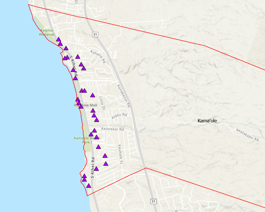
Individual Vacation Units total 60. Promoting shopping, dining and activity options within Kamaole can help create a “walking vacation” trend, reducing reliance on cars and concentrating the customer base for Kamaole businesses.
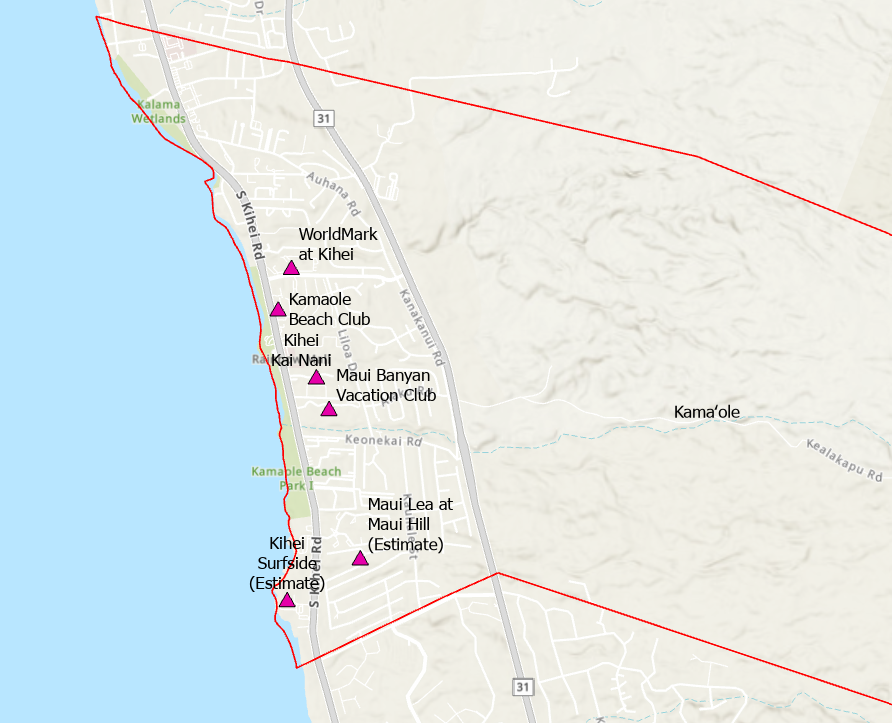
Six properties operate as a Timeshare.
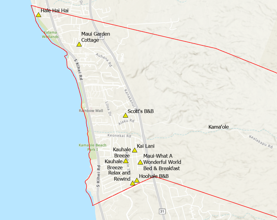
Nine properties operate as Bed and Breakfast businesses.
Properties listed in the “Hotels” data layer have a large impact on our community. The visitors using these facilities are also a source of demand for Kamaole products and services creating revenue to help implement our vision.
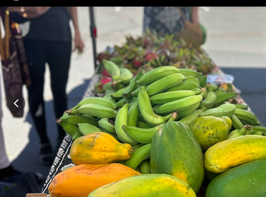
Focusing our attention on how many hotel properties operate in Kamaole helps determine the type and amount of agricultural products necessary to be produced upcountry allowing the “Farm to Table” concept to be implemented. Upcountry producers can plan and deliver accordingly, based on real demand and predictable income.
Make a Donation
Help build the vision of a functioning Modern Day Kamaole Ahupuaa. Small donations and product purchases pay for the website and the cost to develop the Maui Moku Puni Geodatabase until longterm funding is in place and the next generation is trained and leading the way. Every contribution —big or small—helps create a world that reflects our shared values. Your support moves us all closer to a brighter tomorrow.
• High opacity film that’s impossible to see through
• Fast and easy bubble-free application
• Durable vinyl
• 95µ density
Don't forget to clean the surface before applying the sticker.
Digital Konohiki - 4
Modern Day Kamaole Ahupuaa Digital Konohiki
Farm to Table within the Kamaole Ahupuaa
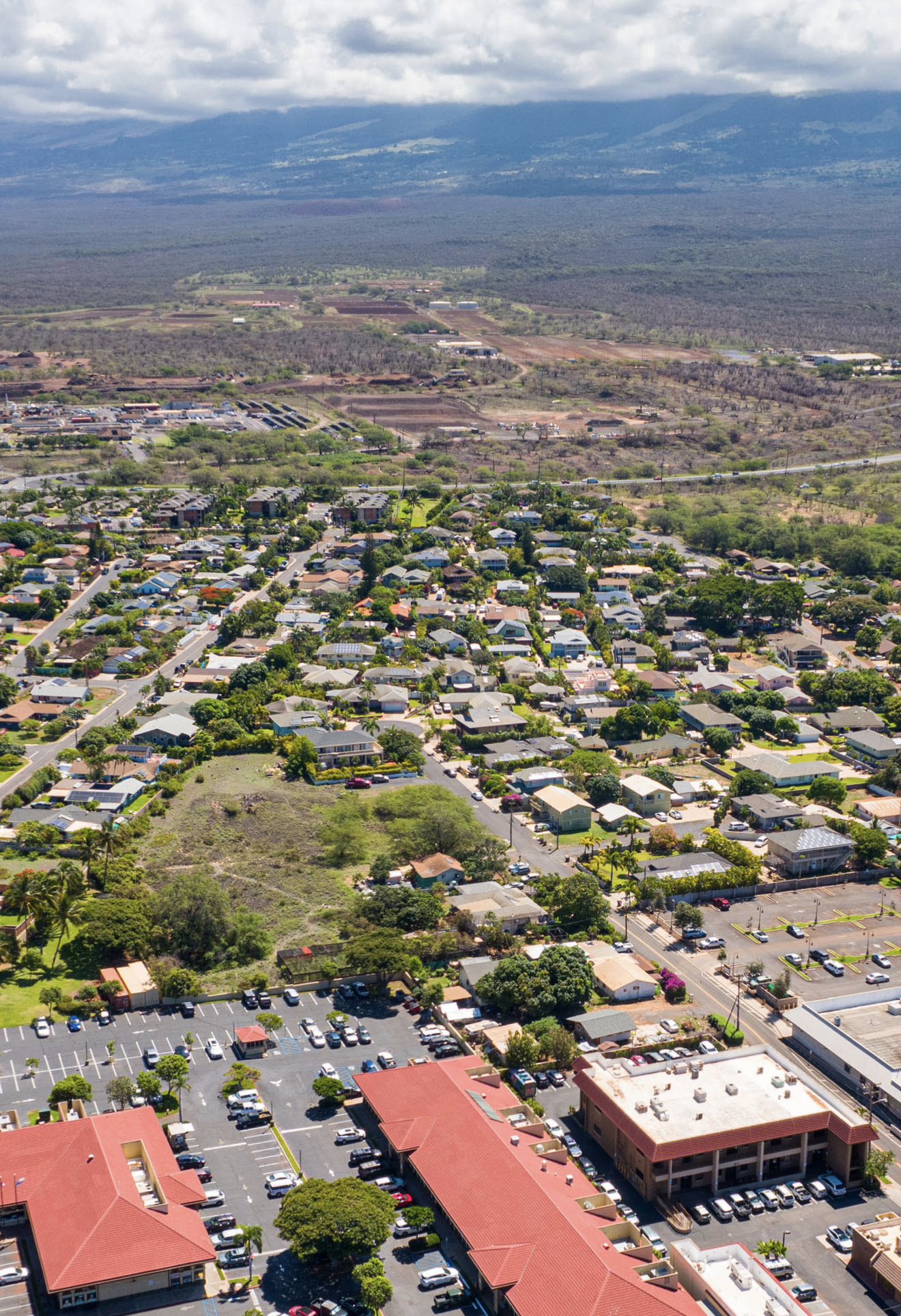
The Modern Day Kamaole Ahupuaa is unique today with its population concentration along the coast and accessible pasture and farm lands Upcountry.
The mix of hotel, condominium, residential and commercial properties and their residents and visitors create the demand for agricultural products produced on the pasture and farm lands Upcountry.
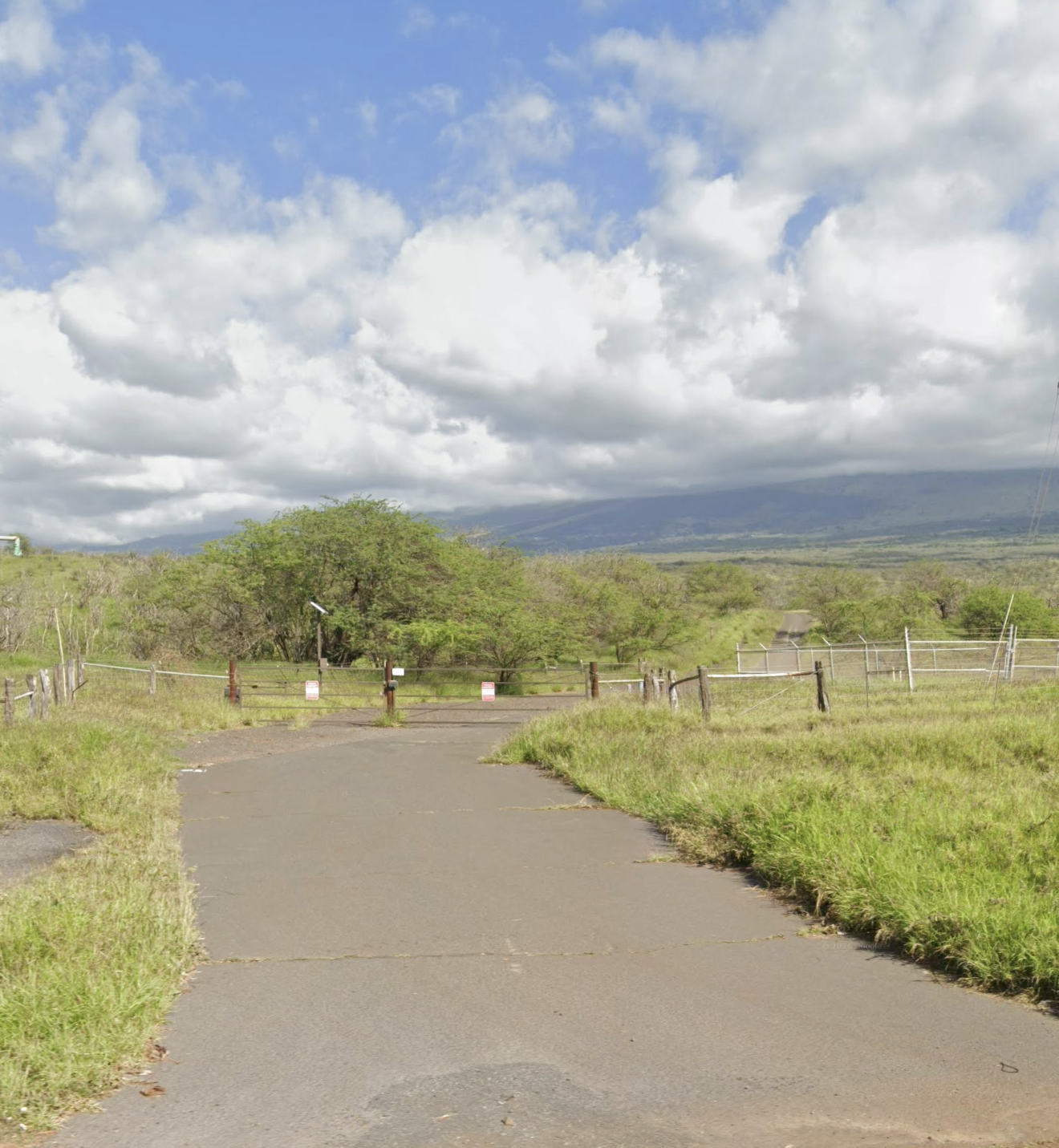
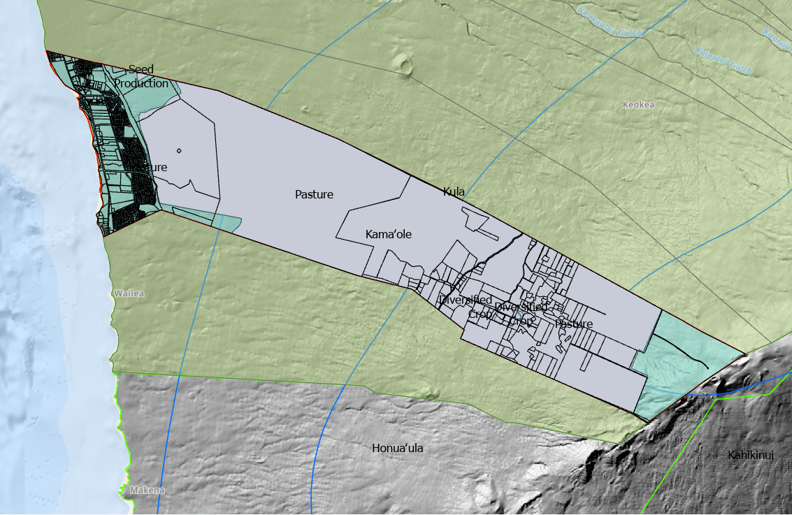
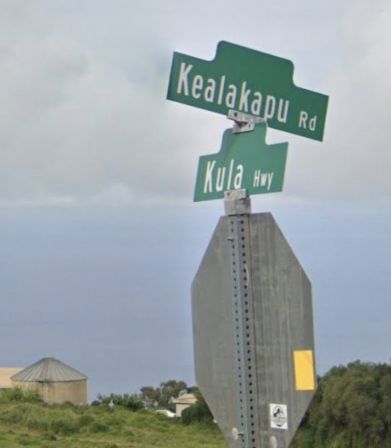
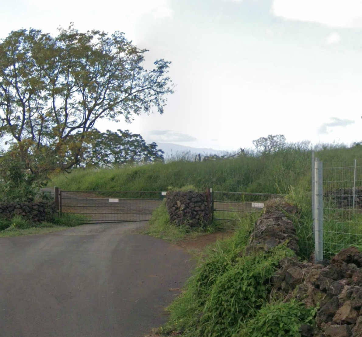
Existing Upcountry Kamaole farms and ranches with direct access to makai population concentrations using Kealakapu Road makes farm to table food production a real possibility today.
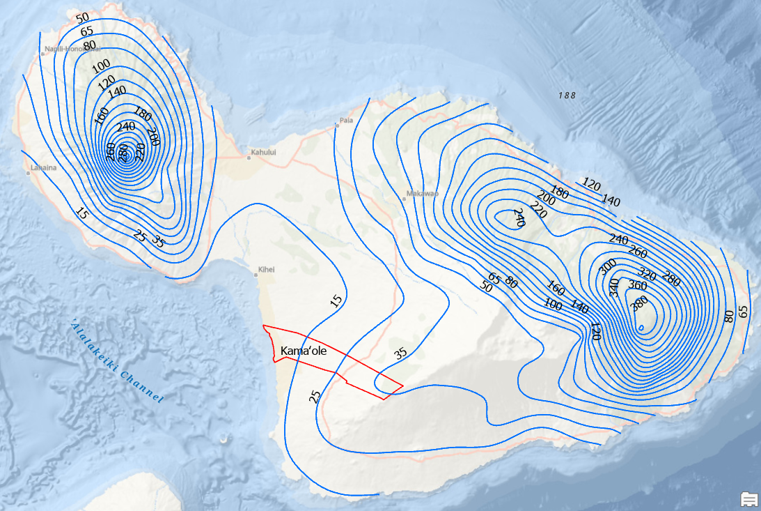
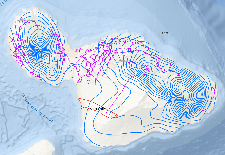
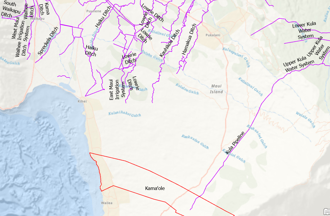
The Kamaole Ahupuaa is located in the rain shadow of the Haleakala volcano. Rainfall contours in inches per year make for easy visualization of wet and dry areas of the Maui Moku Puni. The network of drainage ditches, canals and pipelines constructed in the previous century to supply the sugar cane industry with water are drawn in purple.
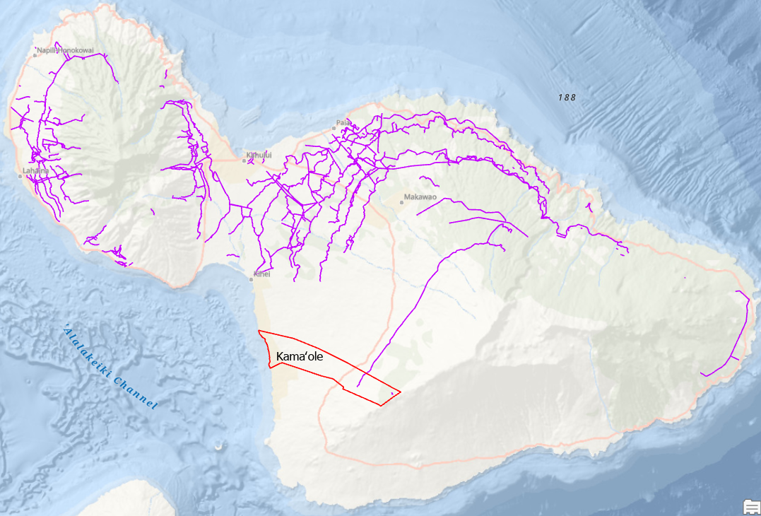
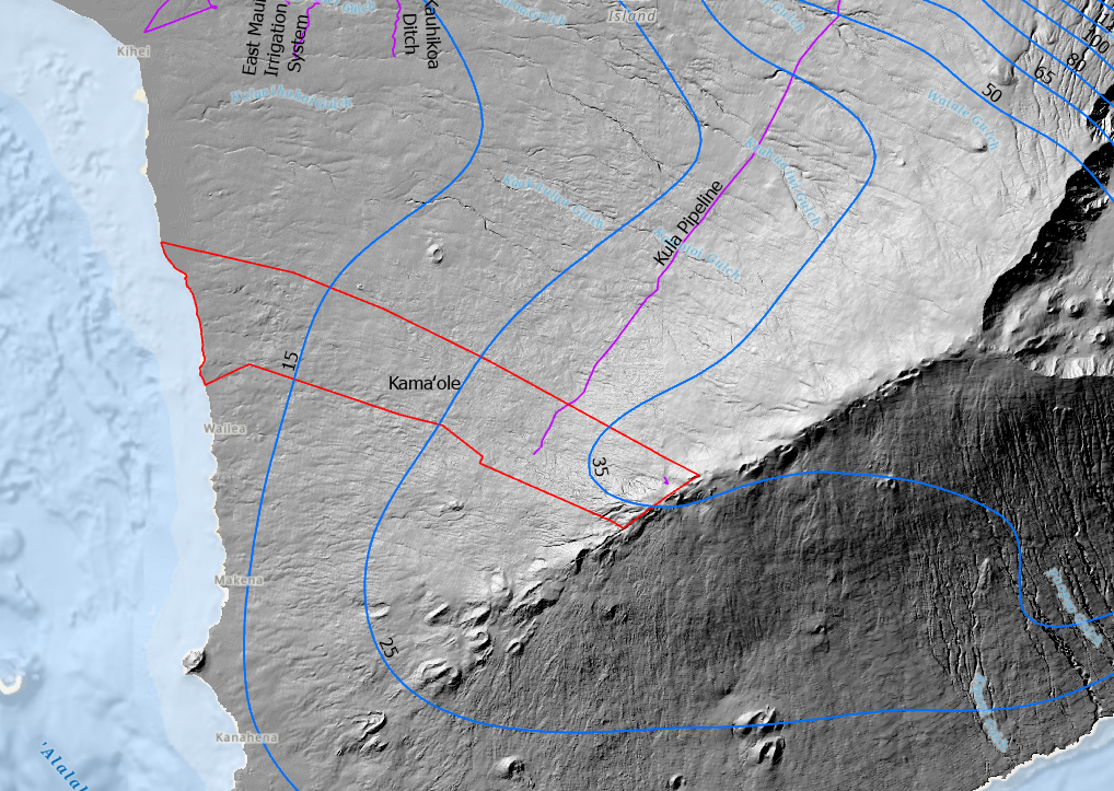
Te Kamaole Ahupuaa stripped to bare earth with LIDAR scanning technology. The Kula Pipeline runs from the wet windward side of the island to the dry leeward side.
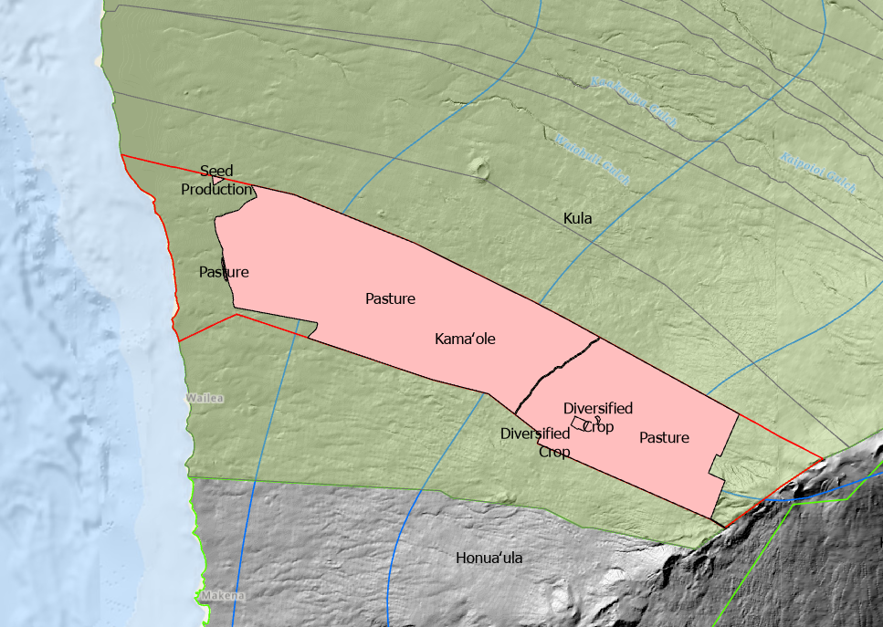
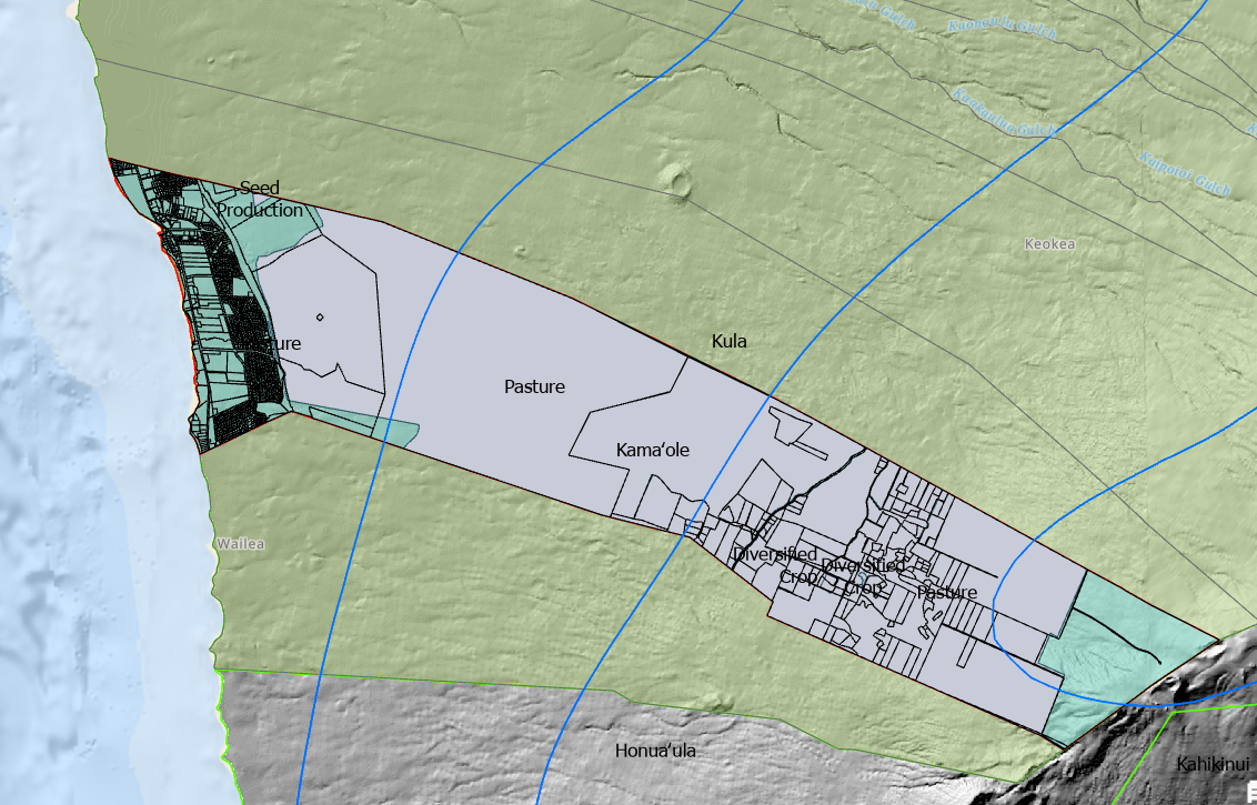
The 2020 Agricultural Use data layer showing pasture, diversified crop and seed production locations within the Kamaole Ahupuaa.

Island wide view of the Hawaii Statewide GIS System 2020 Agricultural Use data layer. A significant portion of the Kamaole Ahupuaa is currently in agricultural use.
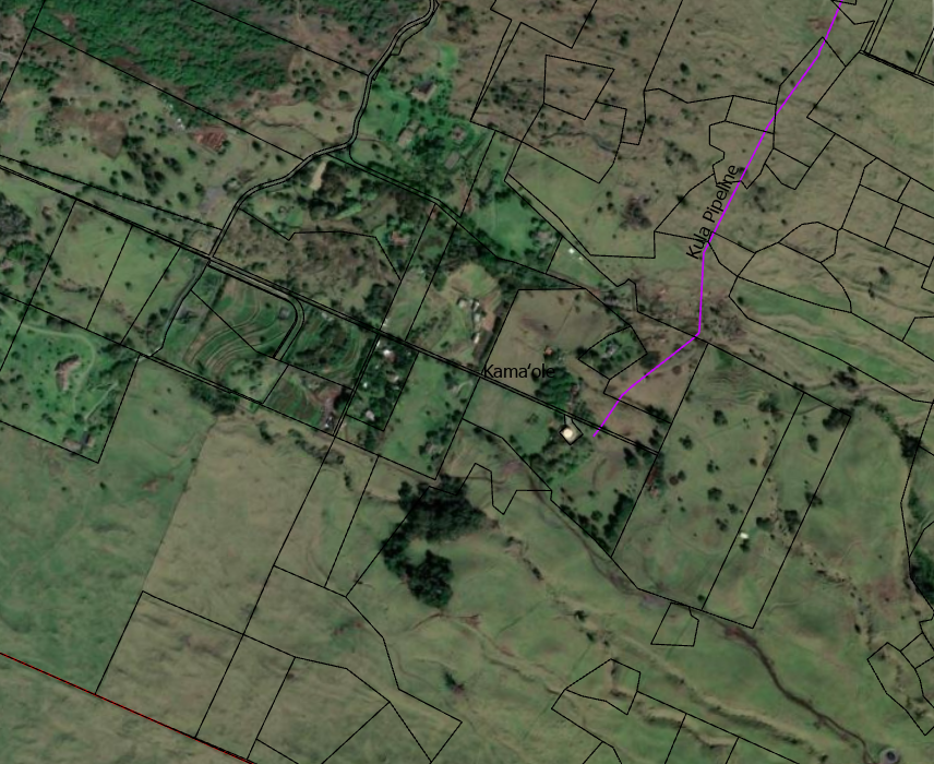
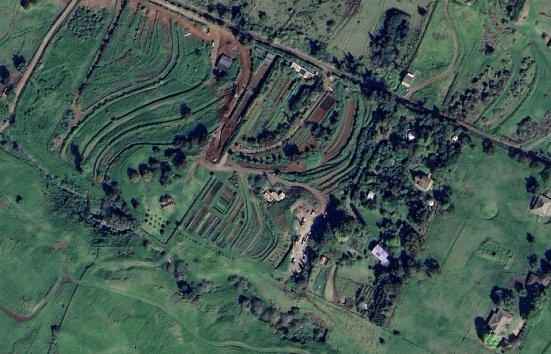
Satellite imagery of Upcountry Kamaole farm and pasture lands in the area receiving 25 - 35 inches of average annual rainfall. The Kula Pipeline is shown in purple. Individually owned Maui County Tax Map parcels are outlined with black lines.
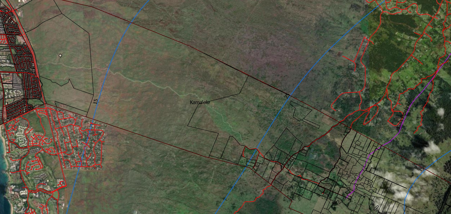
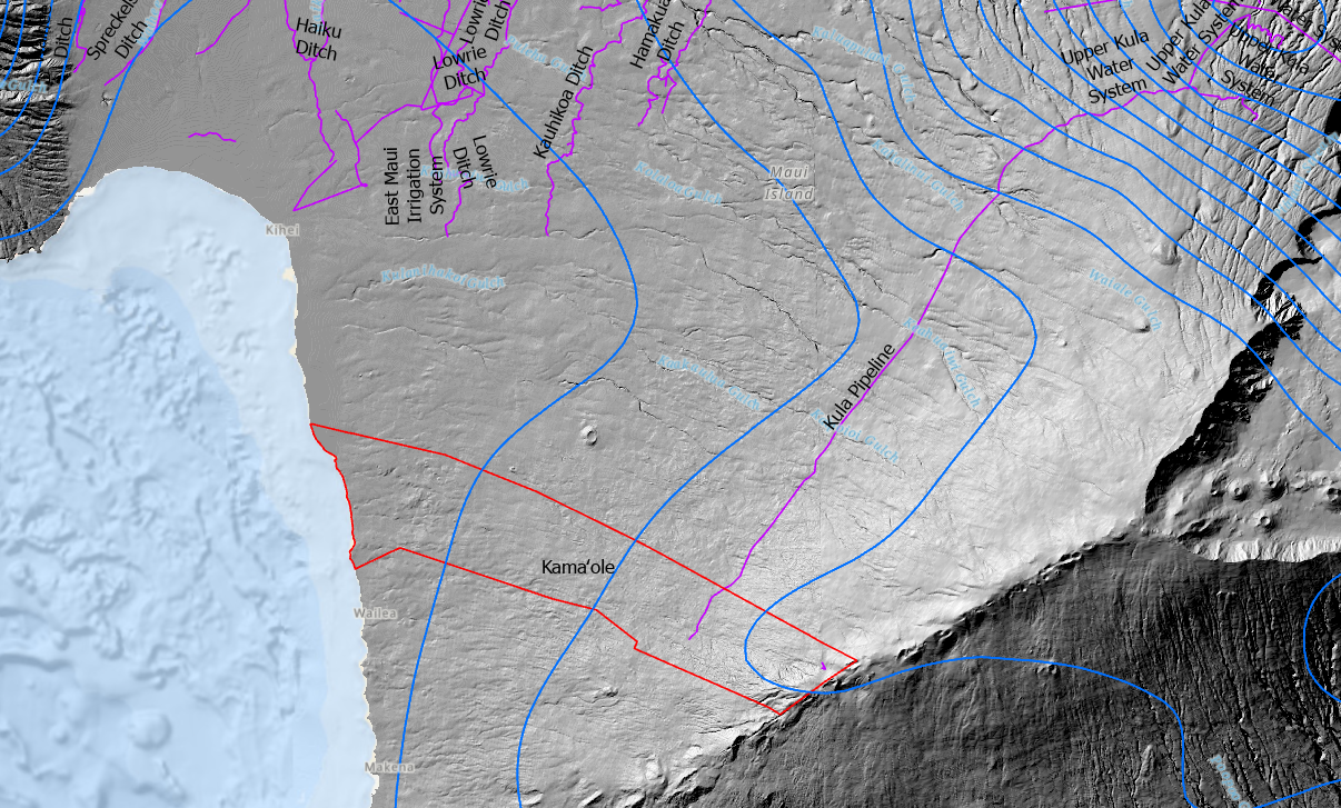
Easy access to mauka pasture and farmlands and makai consumers is a unique situation today. Roads are drawn as red lines. Rainfall contours are the blue lines. Individually owned parcels are outlined in black.
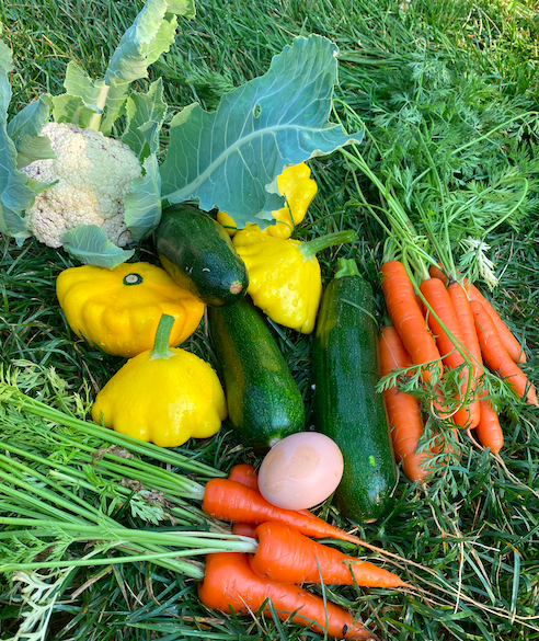
Kamaole farmland is abundant and fertile, ready for the next generation of growers and producers to be inspired by the land.
Make a Donation
Help build the vision of a functioning Modern Day Kamaole Ahupuaa. Small donations and product purchases pay for the website and the cost to develop the Maui Moku Puni Geodatabase until longterm funding is in place and the next generation is trained and leading the way. Every contribution —big or small—helps create a world that reflects our shared values. Your support moves us all closer to a brighter tomorrow.

• Ceramic
• 11 oz mug dimensions: 3.79″ (9.6 cm) in height, 3.25″ (8.3 cm) in diameter
• 15 oz mug dimensions: 4.69″ (11.9 cm) in height, 3.35″ (8.5 cm) in diameter
• Lead and BPA-free material
• Colored rim, inside, and handle
• Dishwasher and microwave safe
Digital Konohiki - 3
Modern Day Kamaole Ahupuaa Digital Konohiki
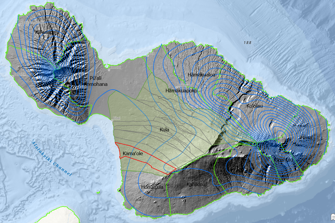
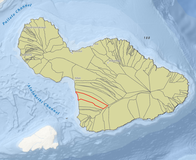
The Kula Moku and the Kamaole Ahupuaa
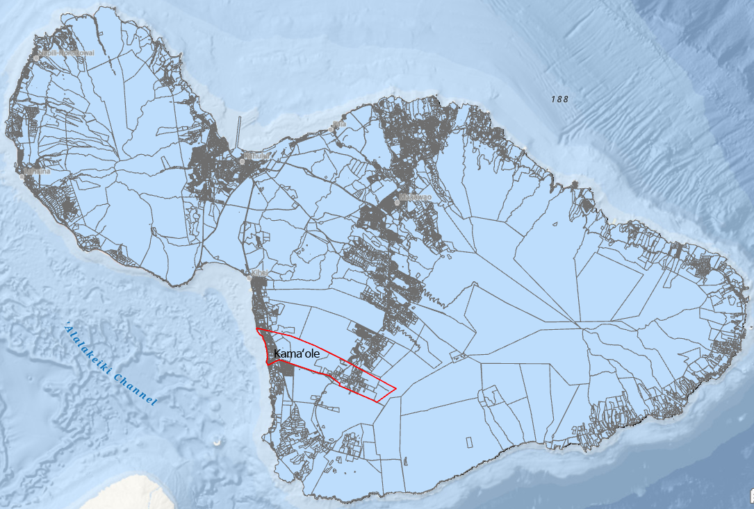
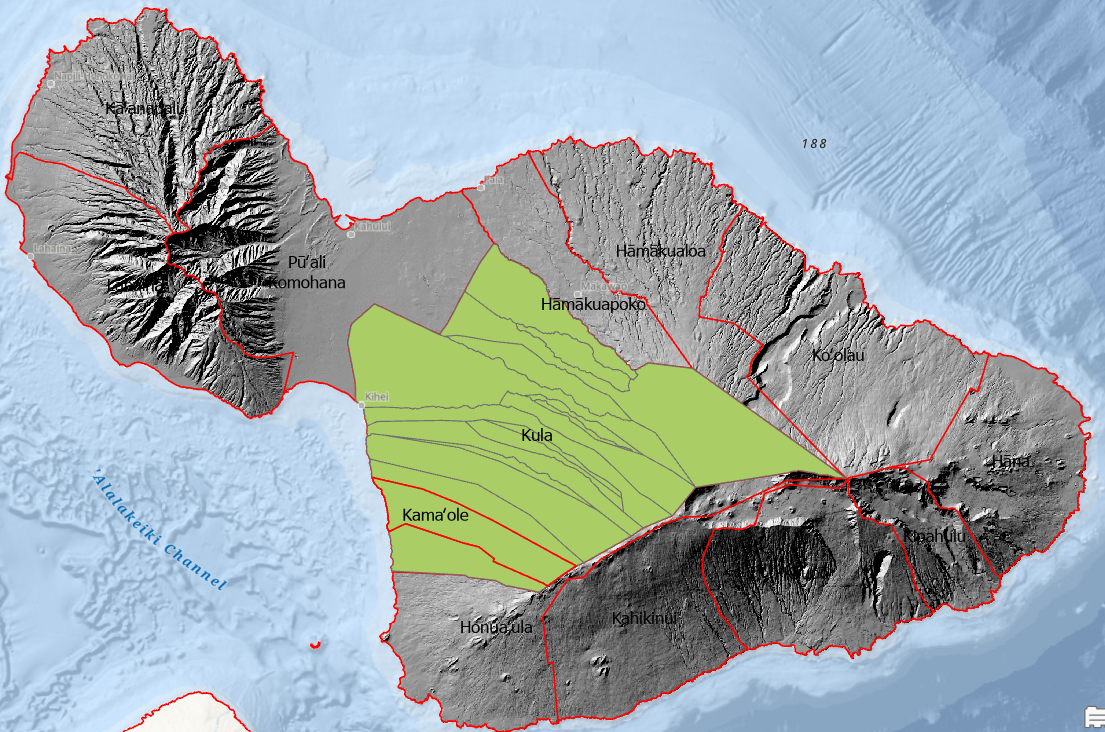
The Kula Moku is the largest of the 12 Moku making up the Maui Moku Puni.

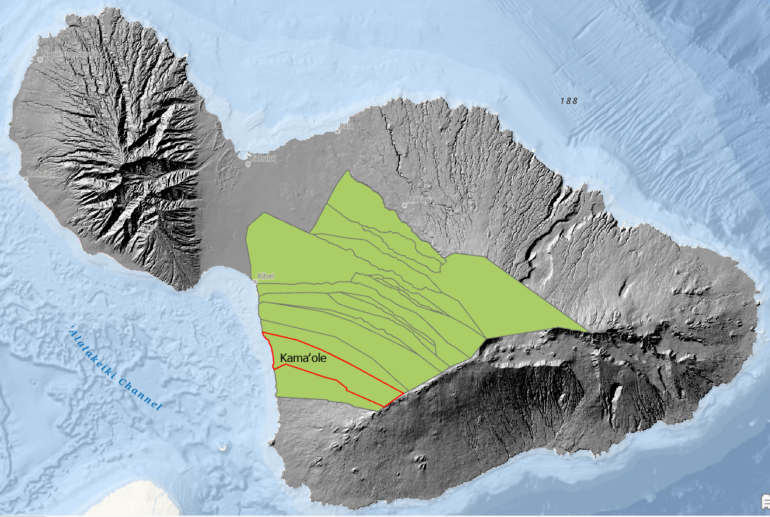
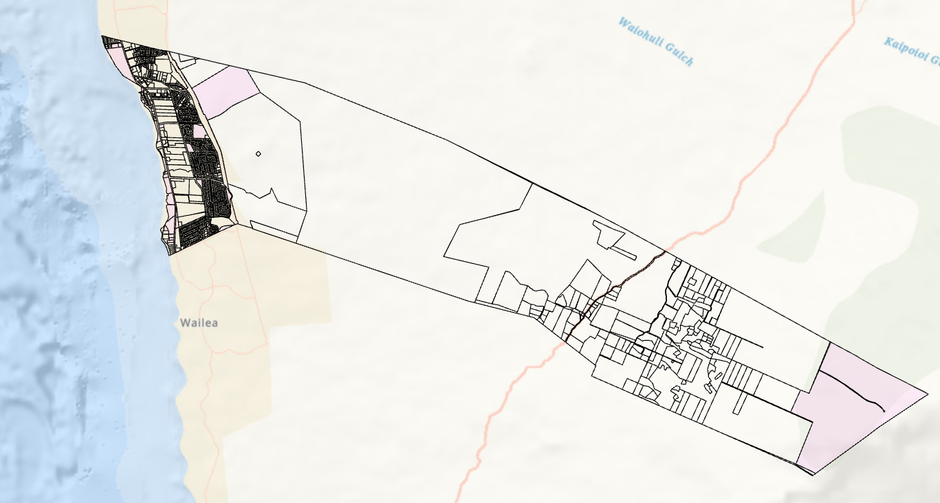
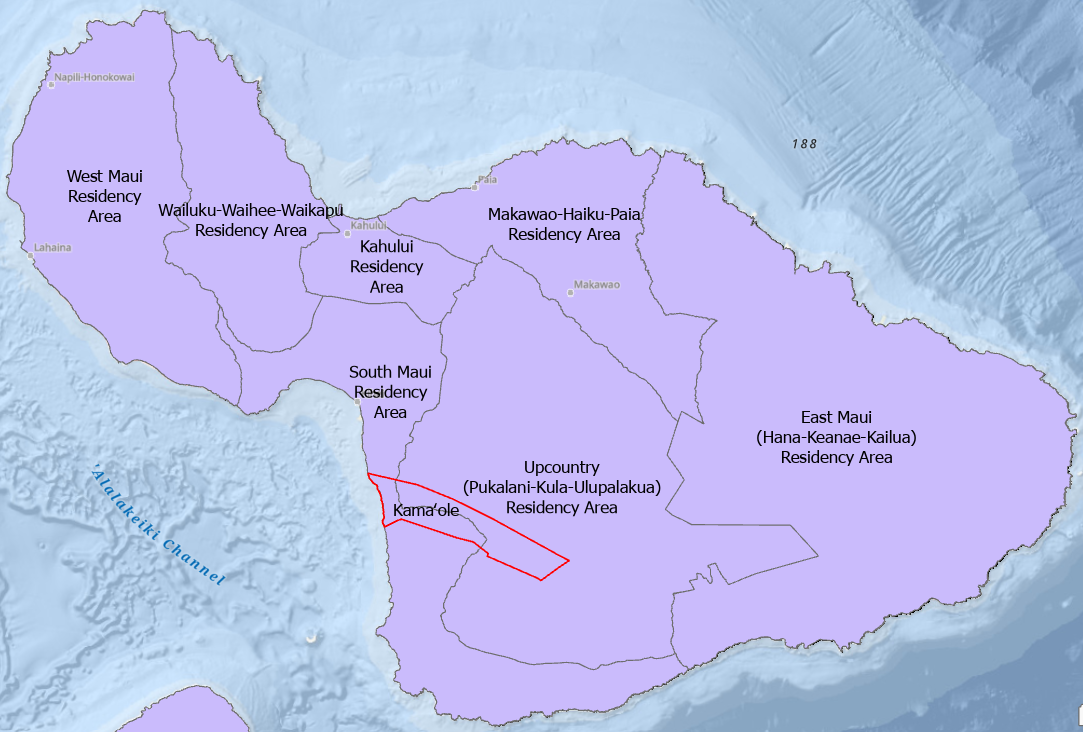
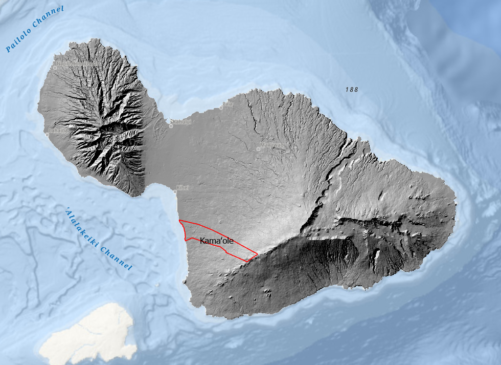
The Kamaole Ahupuaa outlined in red is located on Maui’s dry southwest leeward coast. It is one of seventeen ahupuaa located within the Kula Moku.
Seven of the seventeen Kula Moku Ahupuaa make up the modern day Kihei coastline.
The Modern Day Digital Konohiki powered by the Maui Moku Puni Geodatabase (MMP-GDB) has unlimited ways to view different aspects of the Kamaole Ahupuaa and how it relates to the Kula Moku and the Maui Moku Puni.

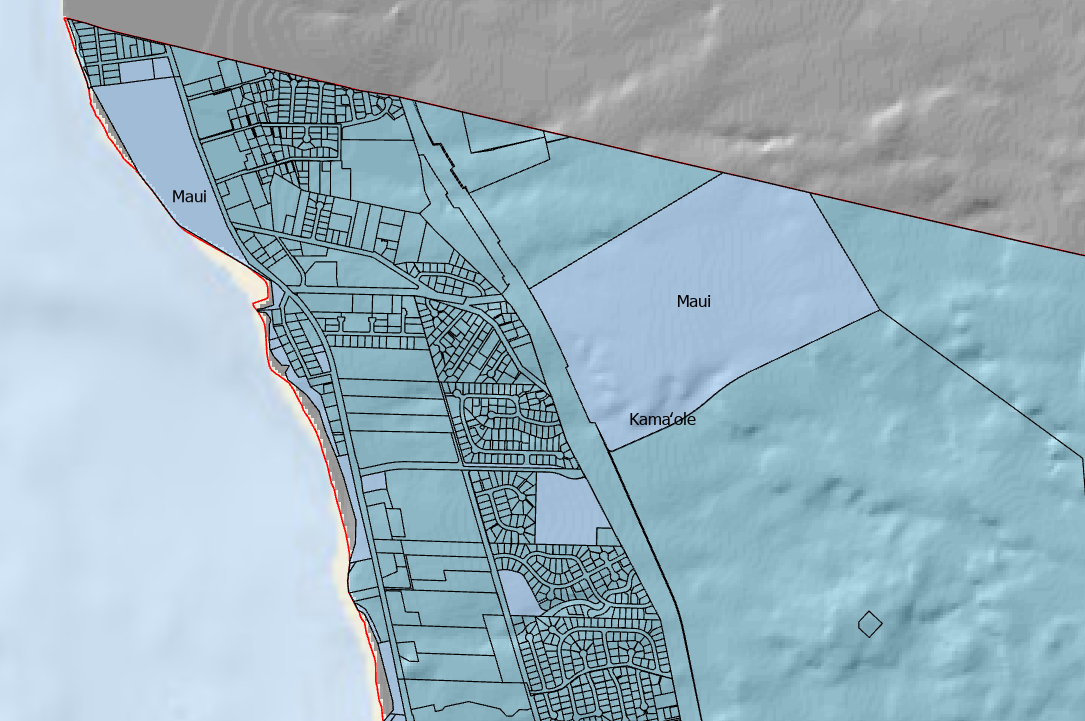
For example the MMP-GDB can be queried to isolate only hotels located within the Kamaole Ahupuaa giving a visual representation of concentration, location and the various statistics associated with each property.
The Digital Konohiki can view tax map parcels, government land, roads, hotels, residential cesspools, or any other combination of data layered together that might yield insight into the activities within the Kamaole Ahupuaa.
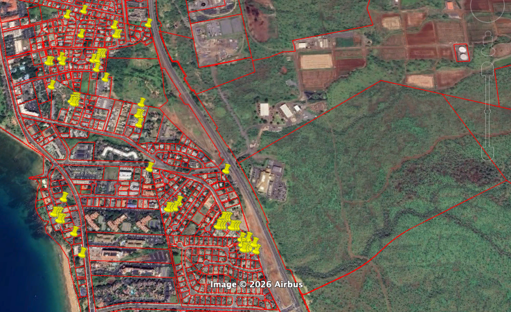

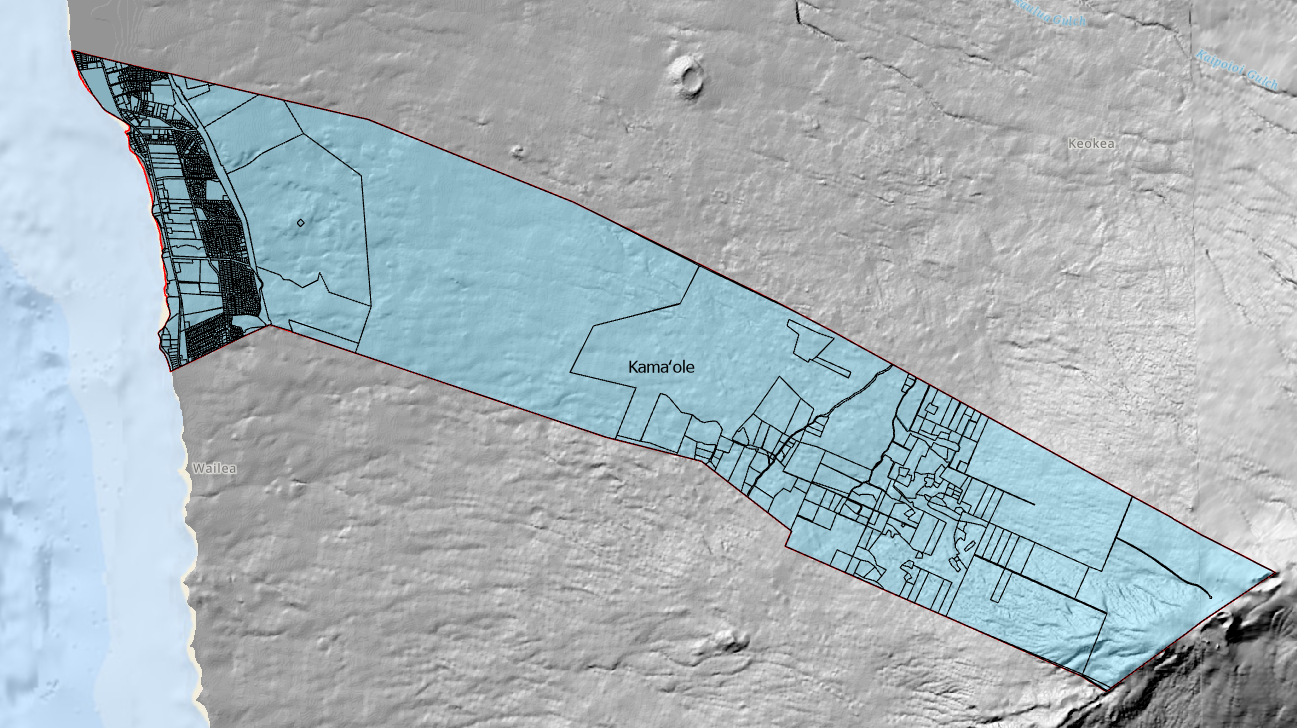
The Kamaole Ahupuaa has 1656 individual tax lots of the 44,923 that make up the Maui Moku Puni today. Government owned land highlighted in pink.

Satellite imagery base map with Maui County Tax Map data layer isolated to the Kamaole Ahupuaa.
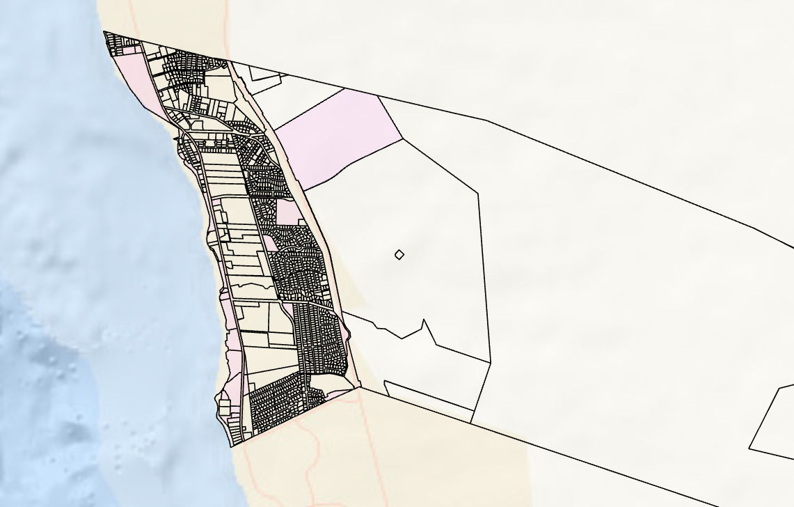
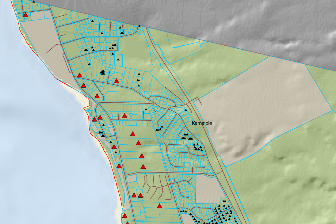
A closer look at the area near the Cove and Kamaole Beach Park 1 and the hotels, tax lots, government land and residential cesspools.
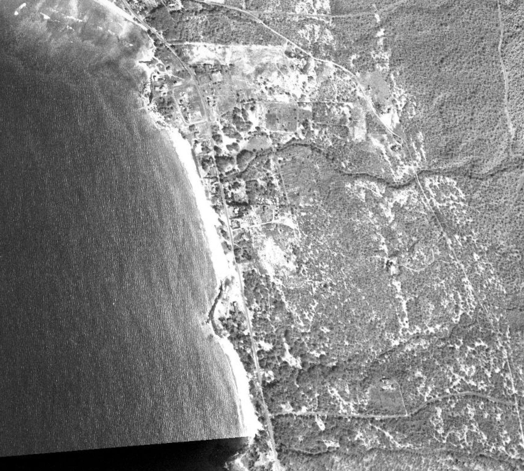
The Digital Konohiki has access to historical photo collections to incorporate into the decision making process.
The Maui Moku Puni Geodatabase (MMP-GDB) in the hands of the Modern Day Kamaole Ahupuaa Digital Konohiki changes the way we see the future.
Donate
Help build the vision of a functioning Modern Day Kamaole Ahupuaa. Small donations and product purchases pay for the website and the cost to develop the Maui Moku Puni Geodatabase until longterm funding is in place and the next generation is trained and leading the way. Every contribution —big or small—helps create a world that reflects our shared values. Your support moves us all closer to a brighter tomorrow.
• High opacity film that’s impossible to see through
• Fast and easy bubble-free application
• Durable vinyl
• 95µ density
Don't forget to clean the surface before applying the sticker.
Digital Konohiki - 2
Modern Day Kamaole Ahupuaa Digital Konohiki
The Ahupuaa Land Management System
The Ahupuaa land management system was established in Hawaii, including Maui, over 1000 years ago in response to growing populations and limited natural resources. The uniquely Hawaiian system of land tenure lasted until 1848 when the Kingdom of Hawaii implemented the Great Mahele and the fee simple system we know today was put into place granting each owner absolute, indefinite title to the land and structures allowing them to use, sell, or lease the land freely.

The Maui Moku Puni digital Hillshade layer from the Hawaii Statewide GIS System and the location of the Kamaole Ahupuaa outlined in red along Maui’s leeward Southwest coast.
The Maui Moku Puni was divided into 12 Moku. The Kula Moku and its seventeen individual Ahupuaa was the largest.
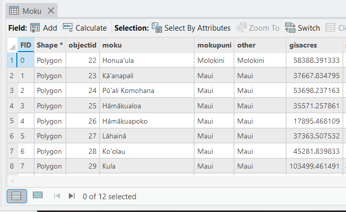
The Maui Moku Puni Geodatabase (MMP-GDB) Moku data layer attribute table with associated data fields is the detailed information behind the visual map.
Maui’s 12 Moku were further divided into 142 Ahupuaa.
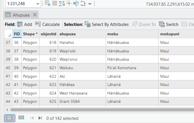
Each individual Ahupuaa and its natural resources were managed by the Konohiki for the Alii.
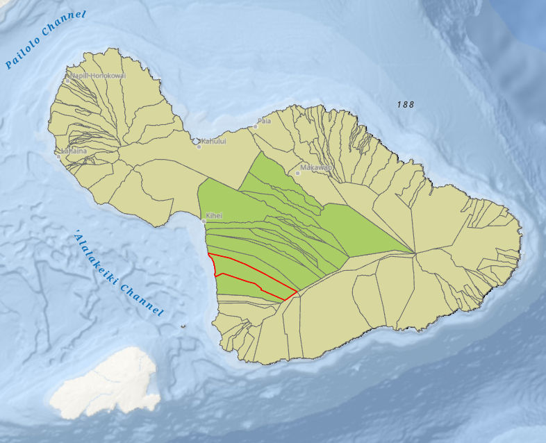
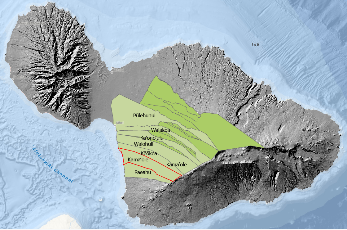
The Kamaole Ahupuaa is one of 17 located within the Kula Moku.
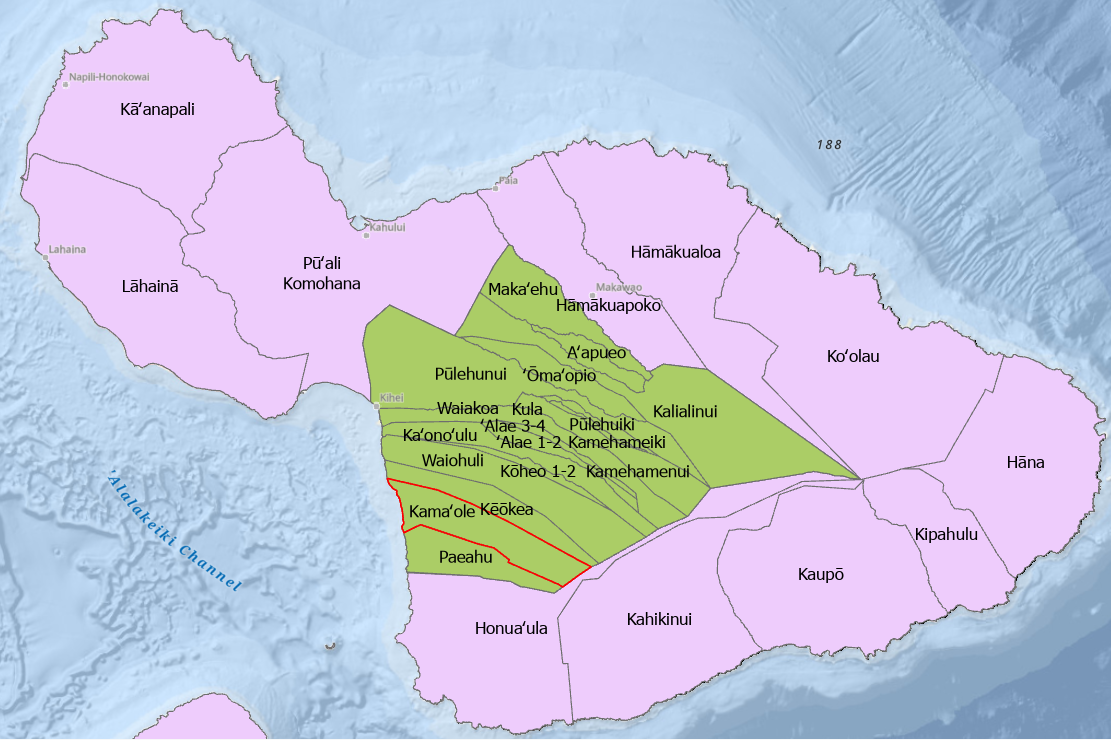
The Kula Moku and the 17 Ahupuaa within its boundaries.
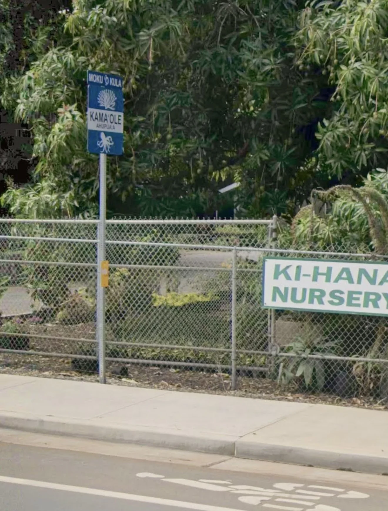
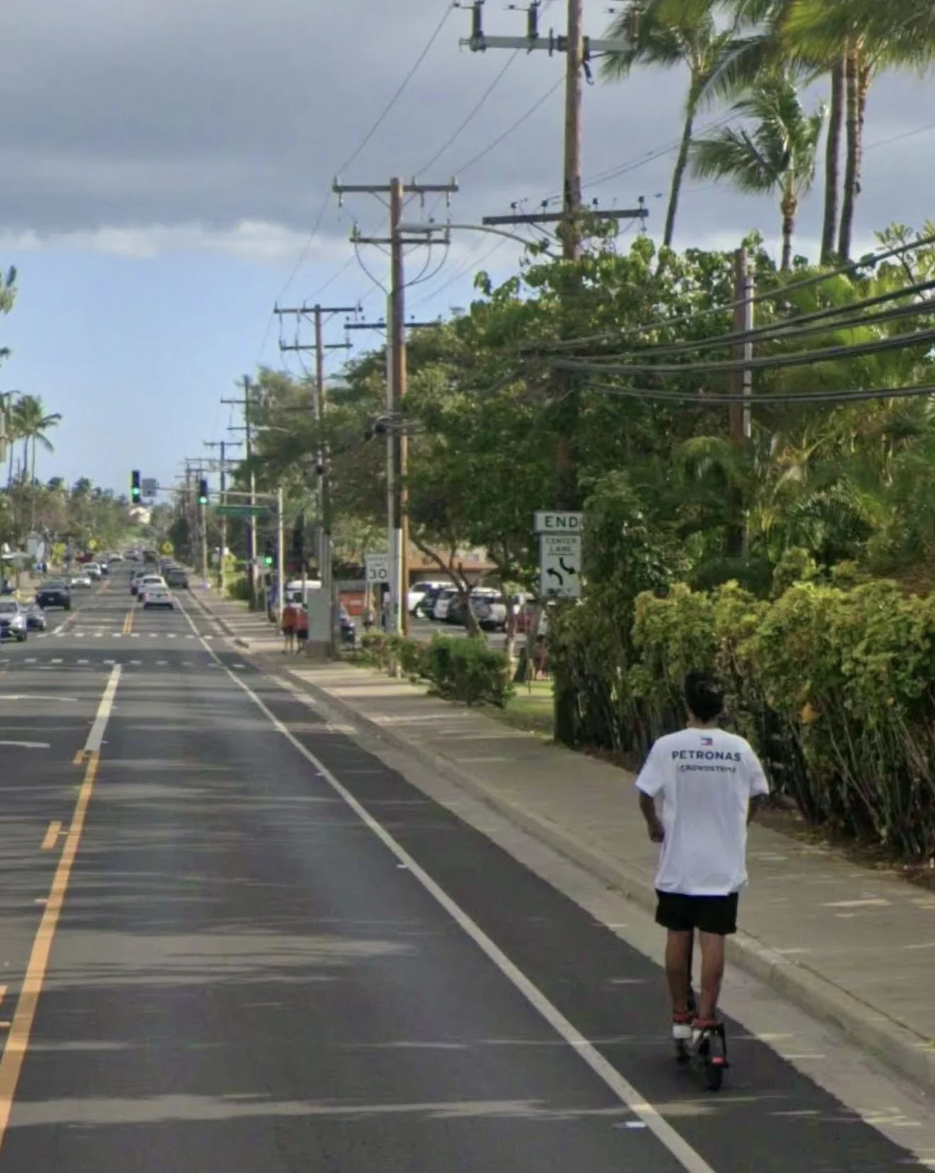
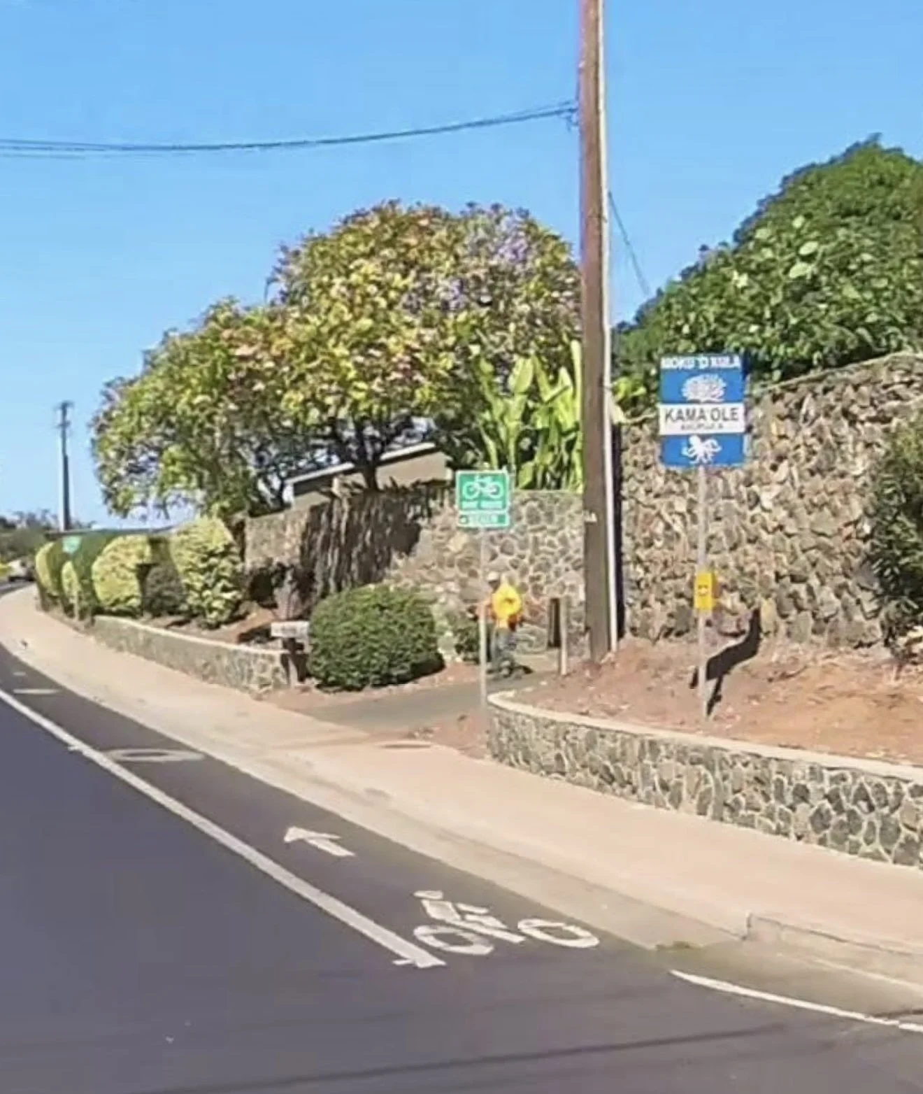
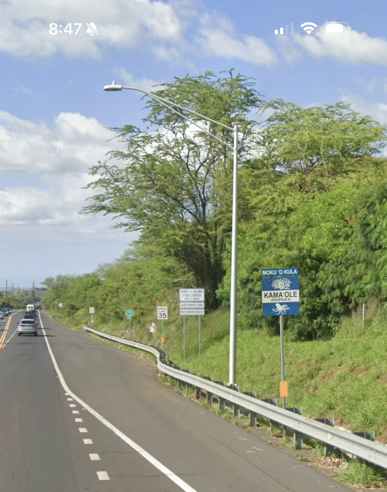
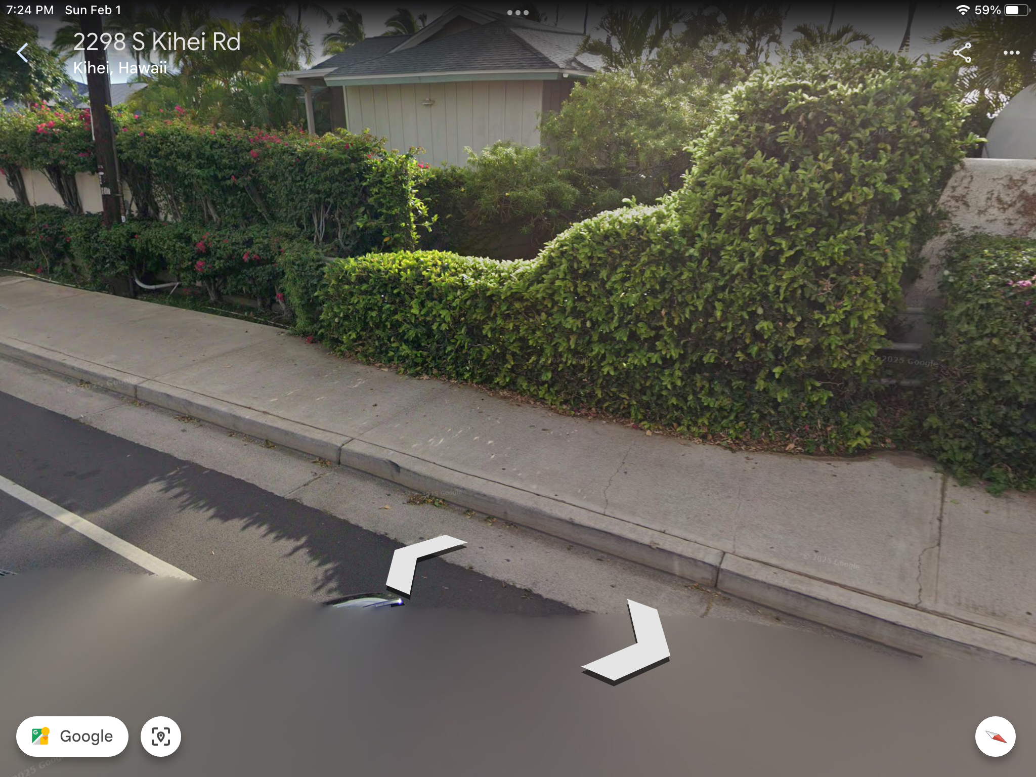
There are seven Kula Moku Ahupuaa that make up the modern day Kihei coastline. On South Kihei Road the north boundary of the Kamaole Ahupuaa is just past the fire station at Kihana Nursery. On the south end the boundary is Kllohana Rd. and Keawekapu Beach. Signs placed by the Maui Nui Ahupuaa Project marking the boundaries are visible along the road.
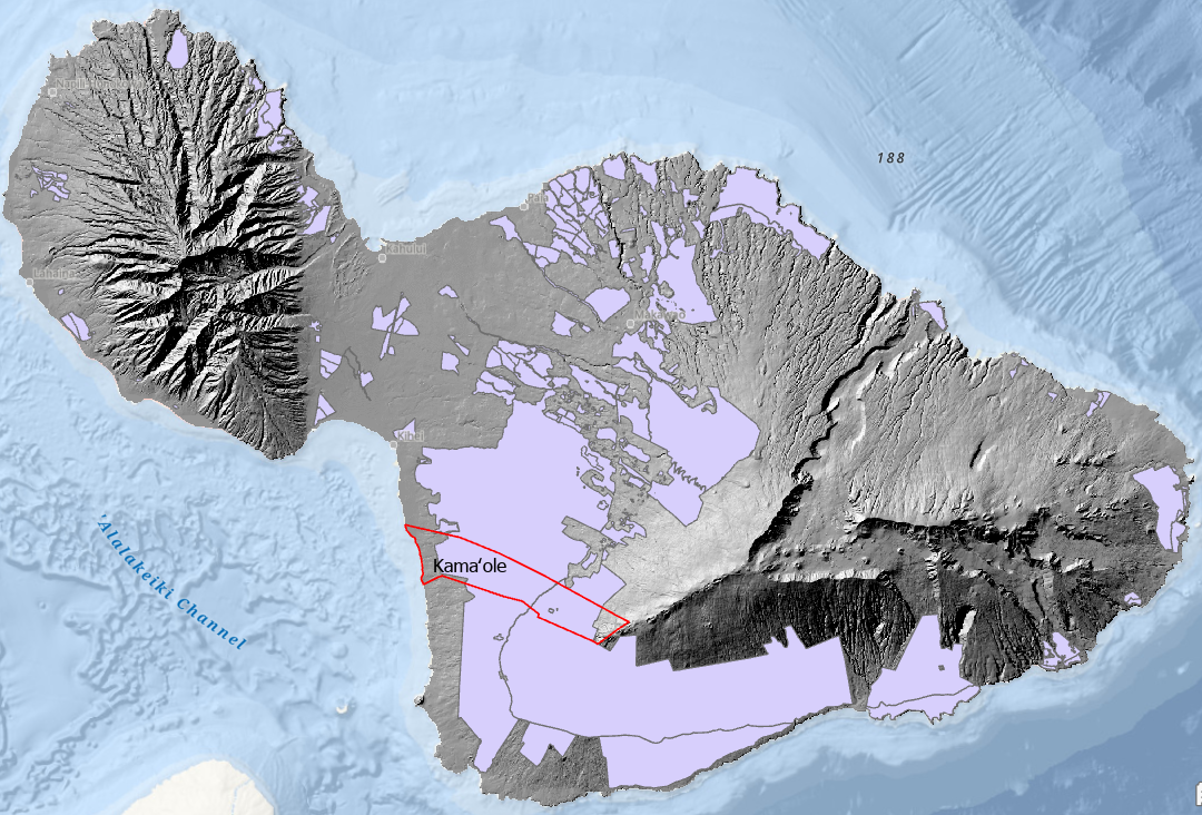
Maui County Council District boundaries divide the Kamaole Ahupuaa separating the lower makai section from upper mauka area. Today there is a patchwork of jurisdictions managing different aspects of the Maui Moku Puni.

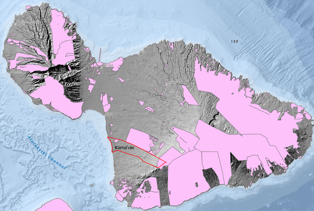
MMP-GDB Government Land Data Layer.

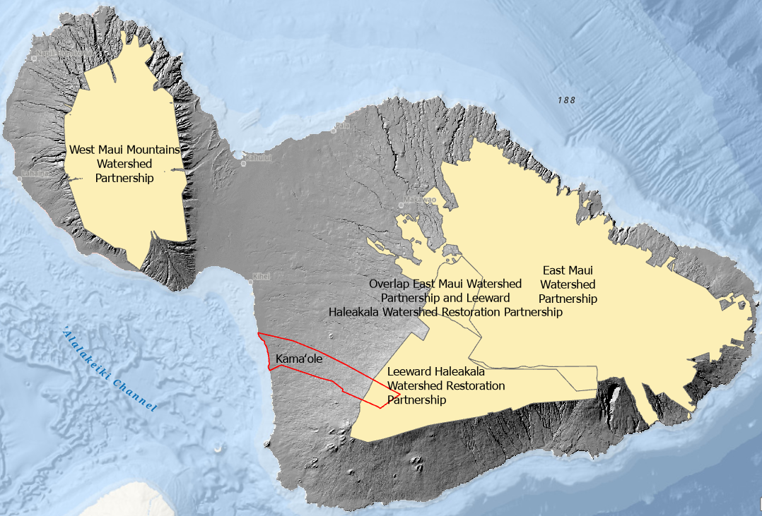
MMP-GDB Watershed Management Districts Data Layer.
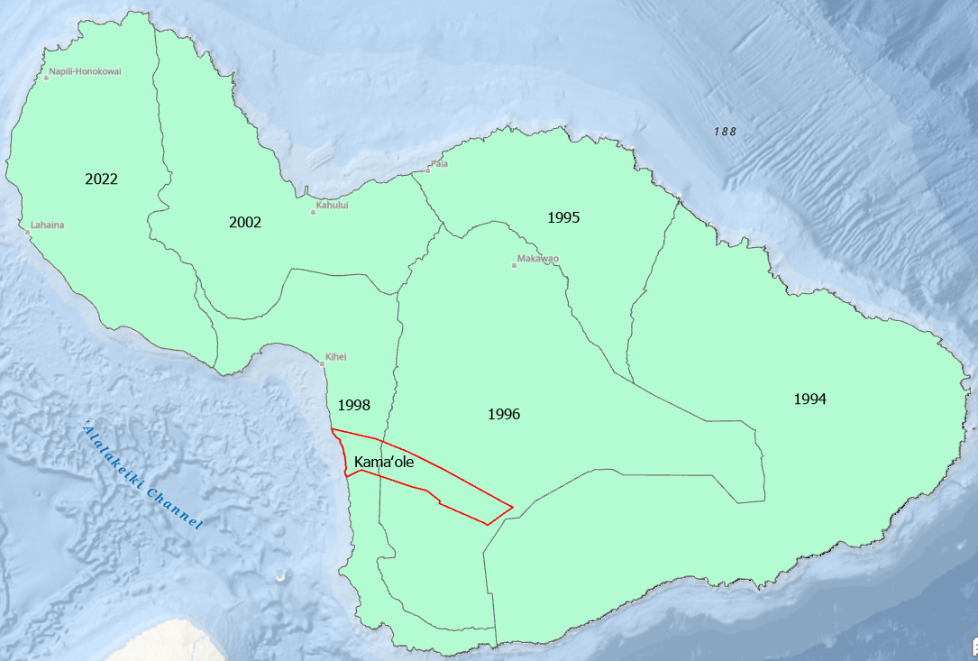
The Maui Moku Puni is currently managed with Community Plans to control growth and manage use and development. The 2025 Draft South Maui Community Plan is available for review.

Todays fee simple land management system has the Maui Moku Puni divided up into over 44,000 individual private and government owned parcels versus the communally managed 12 Moku and 142 Ahupuaa of the time tested Ancient Hawaiian Ahupuaa Land Management System.
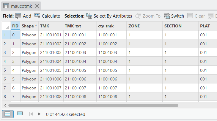
Maui County Tax Map Data Layer currently has 44,923 individual records.
Make a Donation
Help build the vision of a functioning Modern Day Kamaole Ahupuaa. Small donations and product purchases help pay for the website and the cost to develop the Maui Moku Puni Geodatabase until longterm funding is in place and the next generation is trained and leading the way. Every contribution —big or small—helps create a world that reflects our shared values. Your support moves us all closer to a brighter tomorrow.
• Hardboard MDF 0.12″ (3 mm)
• Cork 0.04″ (1 mm)
• High-gloss coating on top
• Size: 3.74″ × 3.74″ × 0.16″ (95 × 95 × 4 mm)
• Rounded corners
• Water-repellent, heat-resistant, and non-slip
• Easy to clean
The displayed price is for a single item.
Digital Konohiki - 1
Modern Day Kamaole Ahupuaa Digital Konohiki
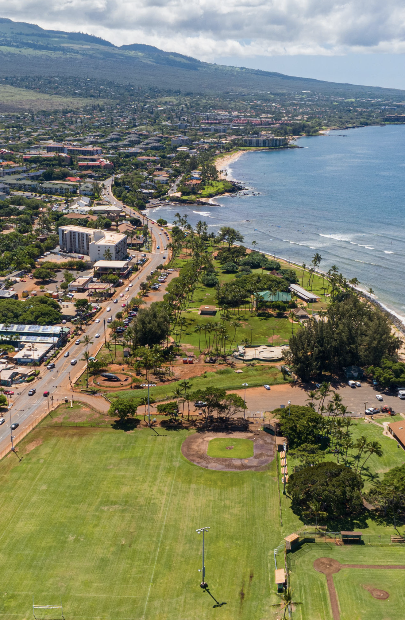
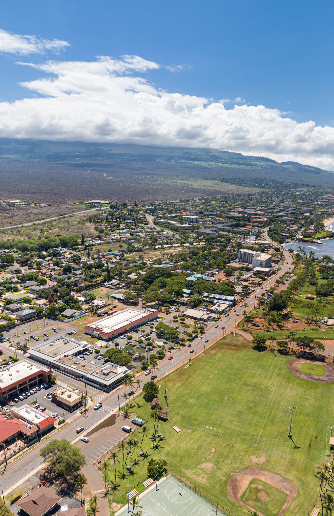
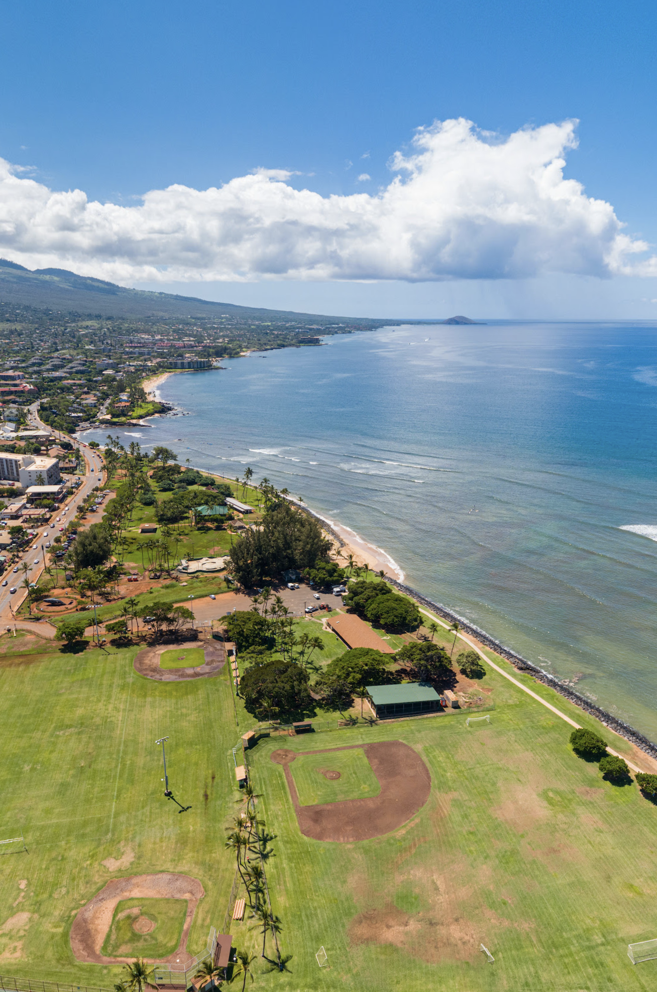
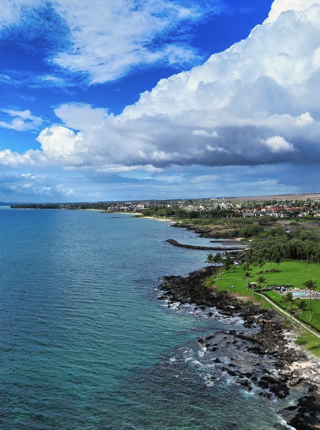
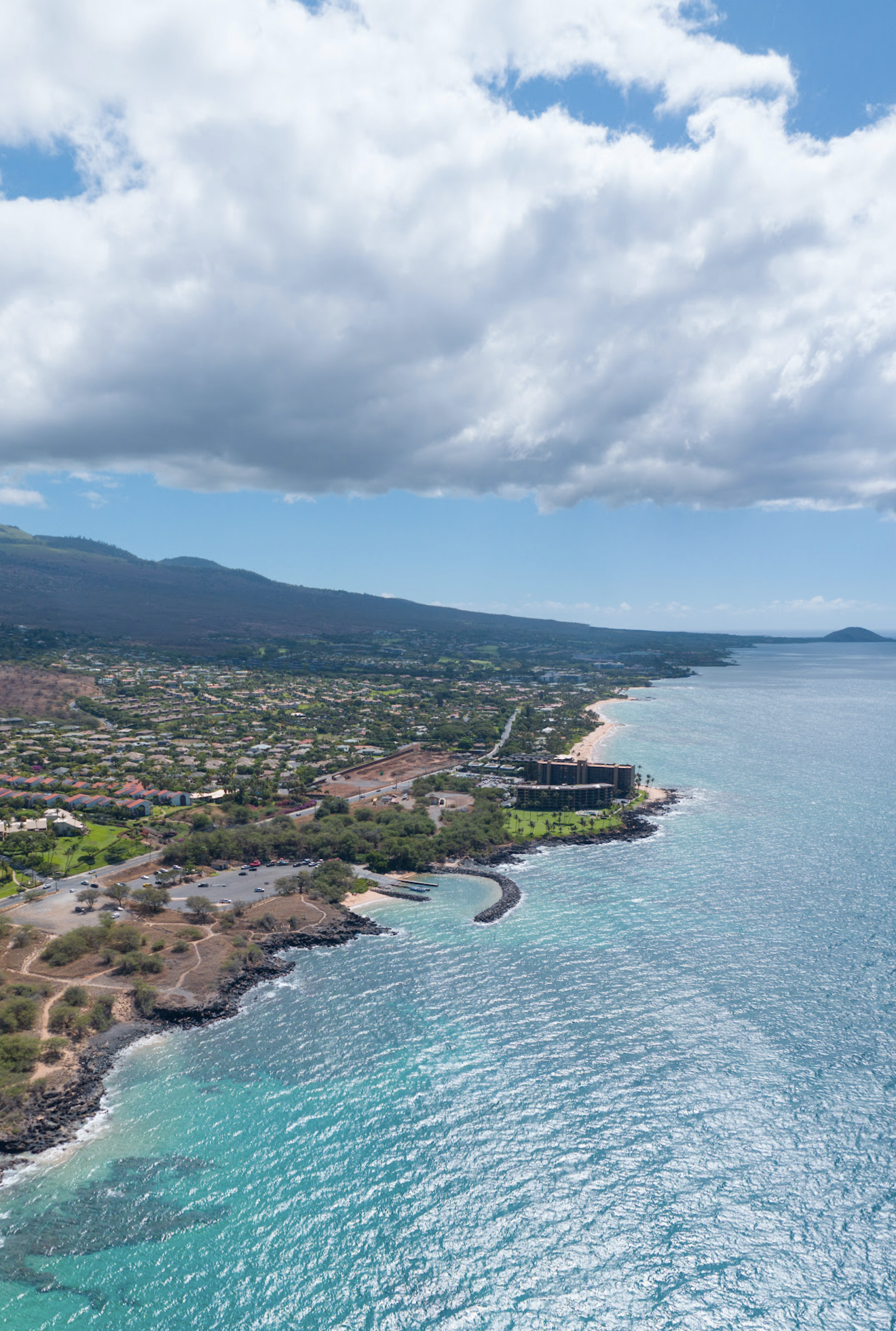
Kamaole 1 Beach Clean-Up Project
The Maui Moku Puni Geodatabase (MMP-GDB) and the Hawaii Statewide GIS System act as the Spatial Nervous System of the Modern Day Kamaole Ahupuaa.
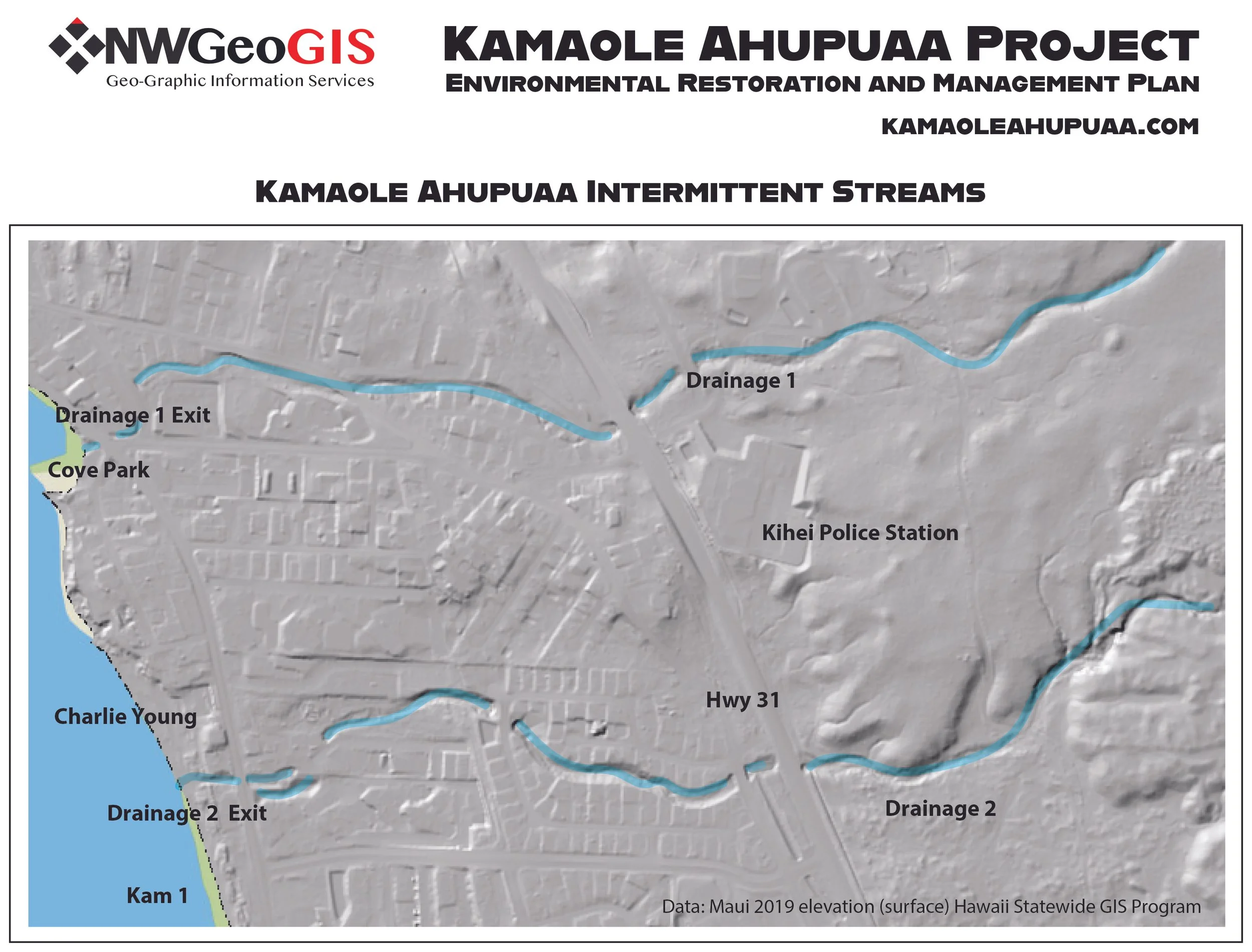
The Hawaii Statewide GIS Digital Terrain Model uses LIDAR scanning technology to give a bare earth base map to improve visualization of drainage and topographical features.
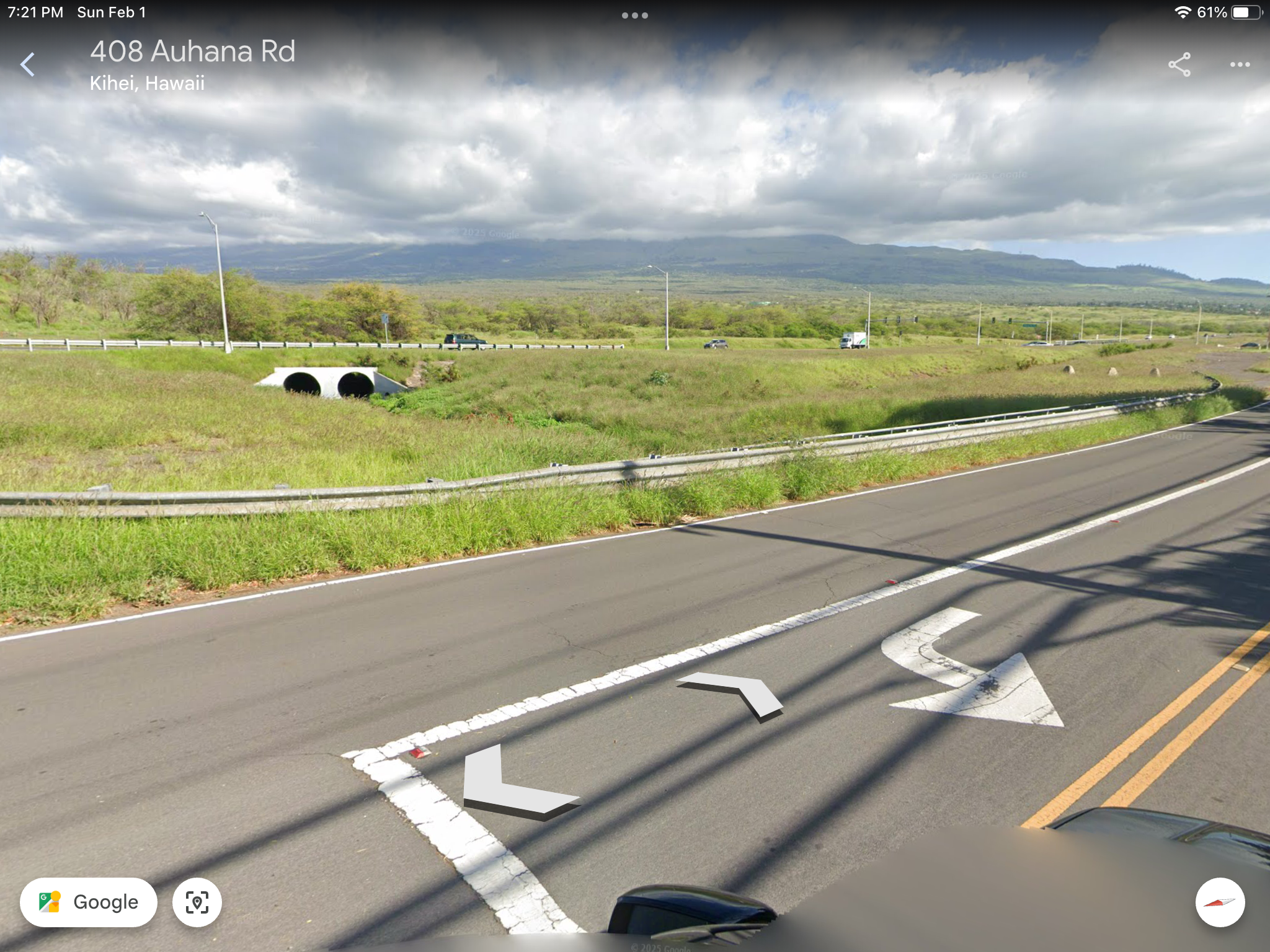
Google Earth screen shots looking at Drainage 2 as it passes under Highway 31 and flows through the lower neighborhoods to Kamaole 1 Beach.
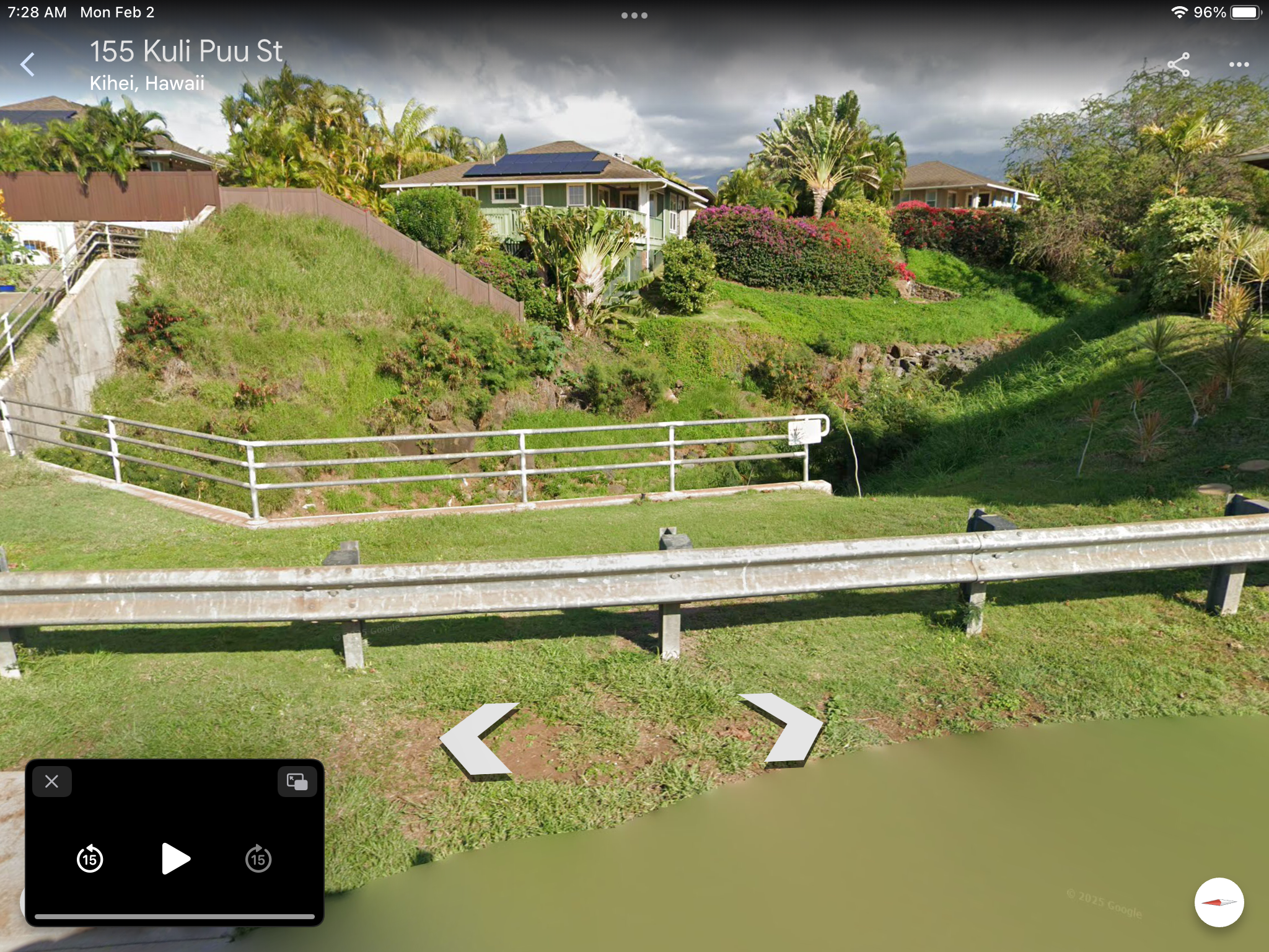
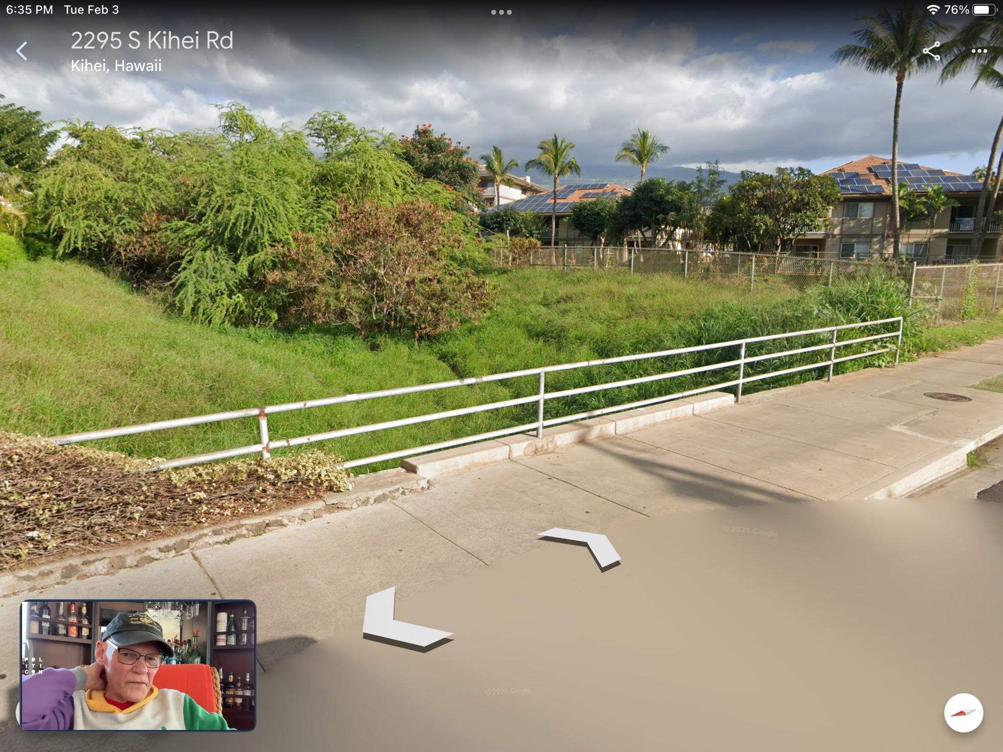
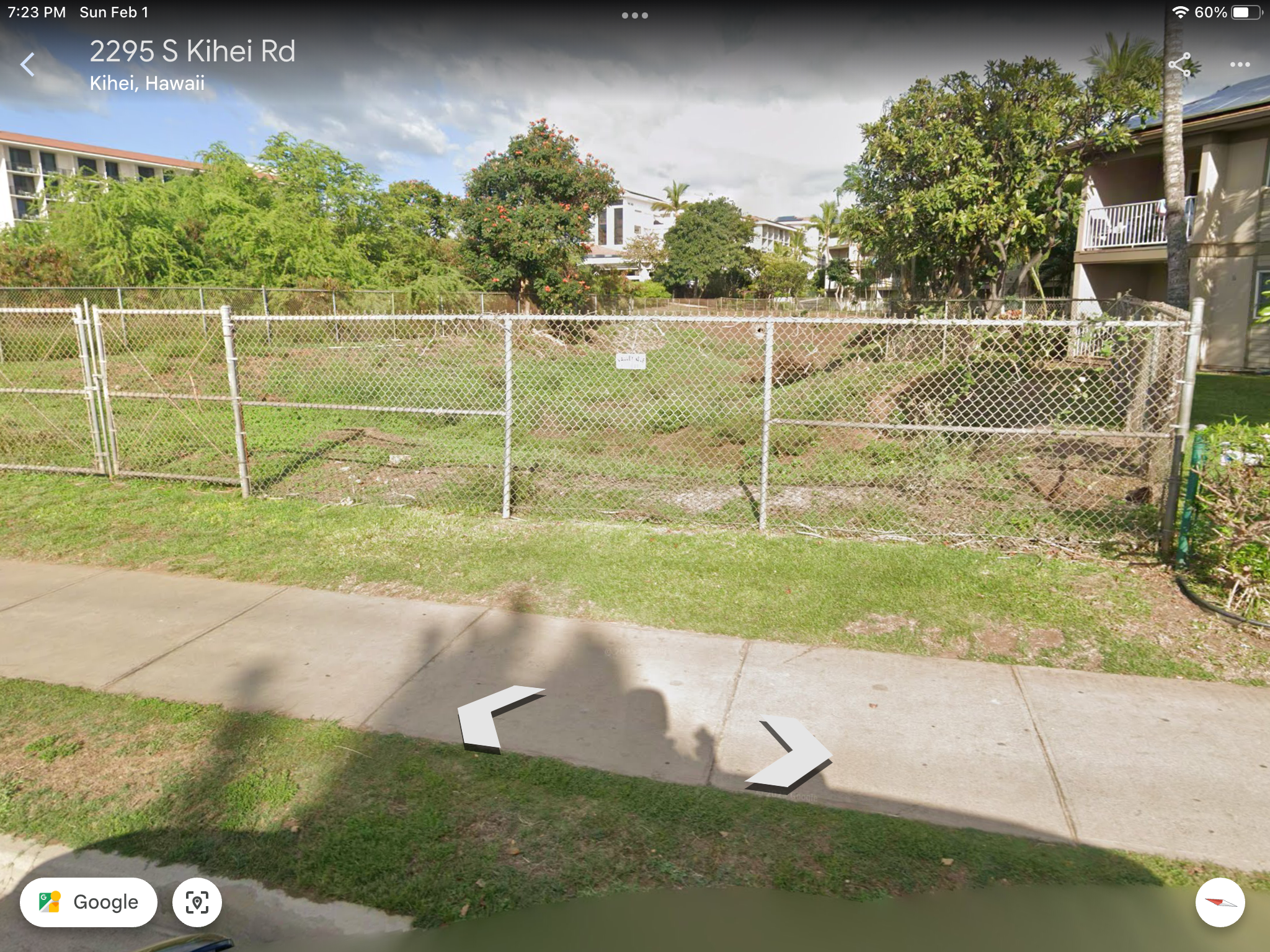
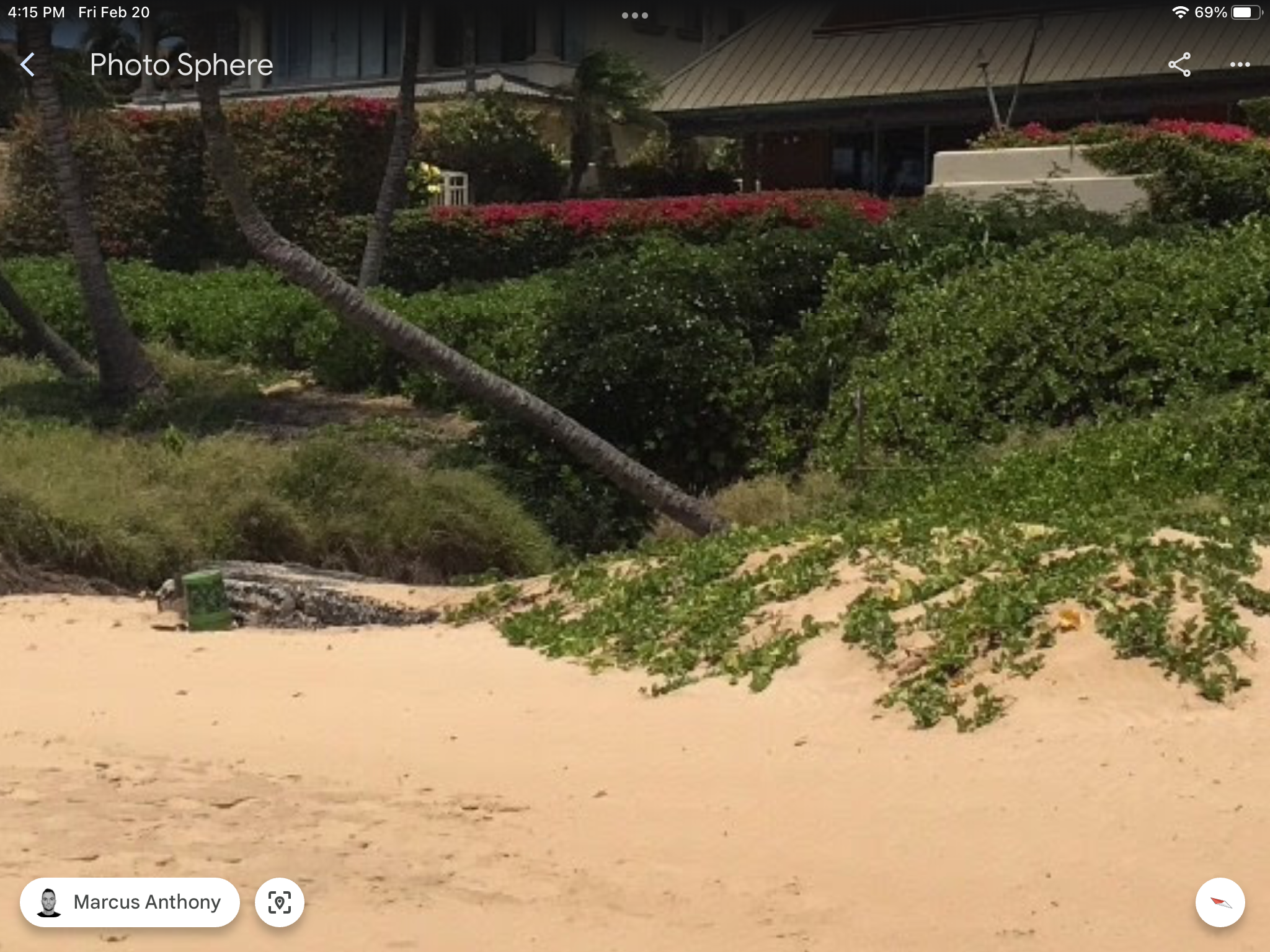
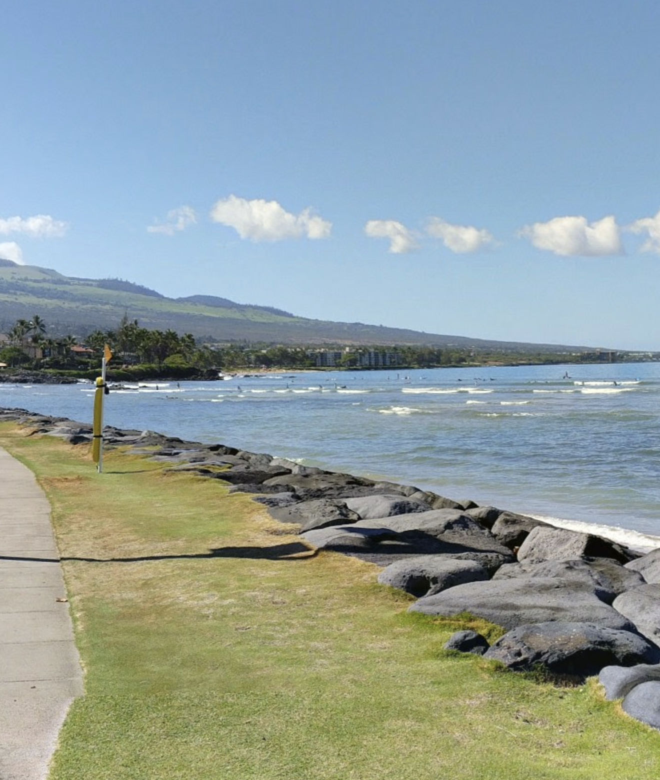
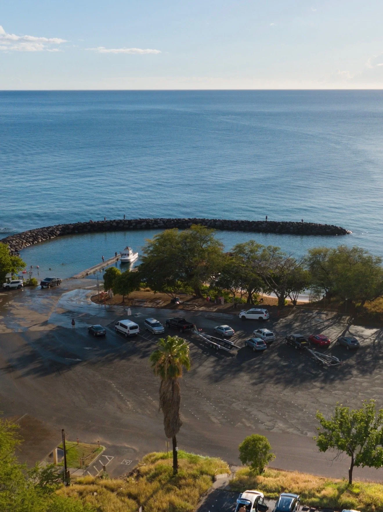
Drainage 2 exit point at the north end of Kamaole 1 Beach Park. Reducing runoff and sedimentation from heavy rainfall events is the longterm challenge.
Make a Donation
Help build the vision of a functioning Modern Day Kamaole Ahupuaa. Small donations and product purchases help pay for the website and the cost to develop the Maui Moku Puni Geodatabase until longterm funding is in place and the next generation is trained and leading the way. Every contribution —big or small—helps create a world that reflects our shared values. Your support moves us all closer to a brighter tomorrow.
• Ceramic
• 11 oz mug dimensions: 3.79″ (9.6 cm) in height, 3.25″ (8.3 cm) in diameter
• 15 oz mug dimensions: 4.69″ (11.9 cm) in height, 3.35″ (8.5 cm) in diameter
• Lead and BPA-free material
• Colored rim, inside, and handle
• Dishwasher and microwave safe